Orientale impact basin, gravity map
Bildnummer 12256431
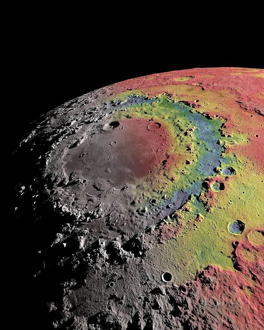
| Orientale impact basin. Free-air gravity map of the Moon's Orientale basin based on data from the Gravity Recovery and Interior Laboratory (GRAIL) mission, overlaid onto digital recreated terrain based on data from the LRO altimeter (LOLA) and camera (LROC) data. Orientale measures 930 kilometers wide and was created by an impact 3.8 billion years ago. Red indicates areas of higher gravity, or excess mass, and blue indicates lower gravity or areas of mass deficits. | |
| Lizenzart: | Lizenzpflichtig |
| Credit: | Science Photo Library / NASA SCIENTIFIC VISUALIZATION STUDIO |
| Bildgröße: | 3000 px × 3750 px |
| Modell-Rechte: | nicht erforderlich |
| Eigentums-Rechte: | nicht erforderlich |
| Restrictions: | - |
Preise für dieses Bild ab 15 €
Universitäten & Organisationen
(Informationsmaterial Digital, Informationsmaterial Print, Lehrmaterial Digital etc.)
ab 15 €
Redaktionell
(Bücher, Bücher: Sach- und Fachliteratur, Digitale Medien (redaktionell) etc.)
ab 30 €
Werbung
(Anzeigen, Aussenwerbung, Digitale Medien, Fernsehwerbung, Karten, Werbemittel, Zeitschriften etc.)
ab 55 €
Handelsprodukte
(bedruckte Textilie, Kalender, Postkarte, Grußkarte, Verpackung etc.)
ab 75 €
Pauschalpreise
Rechtepakete für die unbeschränkte Bildnutzung in Print oder Online
ab 495 €