Earth's clouds simulation, GEOS-5
Bildnummer 12248787
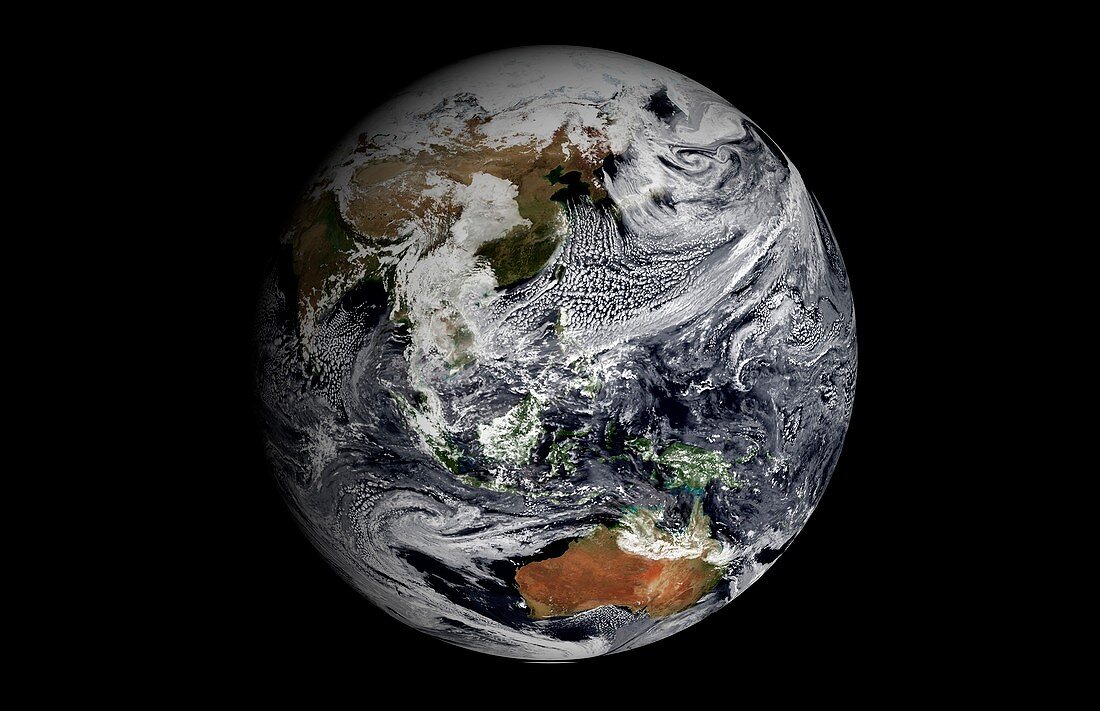
| Earth's clouds simulation, GEOS-5. This still image, part of an animation, is centred over the Malay Archipelago. It was produced using NASA's Goddard Earth Observing System-5 (GEOS-5) atmospheric simulation. The global atmospheric simulation ran at 3.5 km per grid cell and covered a single day: 2 January 2009. The results are shown on a spherical projection of the Earth's surface and are used in weather forecasting. The Earth's surface in this visualisation is constructed from 'Blue Marble: Next Generation' data from the moderate-resolution imaging spectroradiometer (MODIS) sensors on the Terra and Aqua satellites. | |
| Lizenzart: | Lizenzpflichtig |
| Credit: | Science Photo Library / GSFC Scientific Visualization Studio / NASA Earth Observatory |
| Bildgröße: | 5259 px × 3397 px |
| Modell-Rechte: | nicht erforderlich |
| Eigentums-Rechte: | nicht erforderlich |
| Restrictions: | - |
Preise für dieses Bild ab 15 €
Universitäten & Organisationen
(Informationsmaterial Digital, Informationsmaterial Print, Lehrmaterial Digital etc.)
ab 15 €
Redaktionell
(Bücher, Bücher: Sach- und Fachliteratur, Digitale Medien (redaktionell) etc.)
ab 30 €
Werbung
(Anzeigen, Aussenwerbung, Digitale Medien, Fernsehwerbung, Karten, Werbemittel, Zeitschriften etc.)
ab 55 €
Handelsprodukte
(bedruckte Textilie, Kalender, Postkarte, Grußkarte, Verpackung etc.)
ab 75 €
Pauschalpreise
Rechtepakete für die unbeschränkte Bildnutzung in Print oder Online
ab 495 €