Richat Structure, 3D anaglyph
Bildnummer 12248786
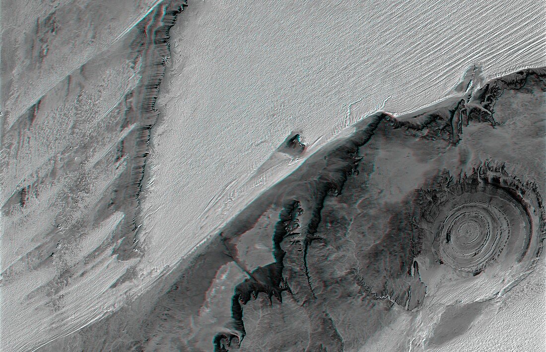
| Richat Structure, 3D anaglyph created by combining satellite radar and infrared data. North is at top. When viewed through special glasses, this anaglyph provides a vertically exaggerated view of the cliffs and sand dunes of the Richat Structure (lower right) and the surrounding desert. This is an eroded volcanic dome in the deserts of Mauritania. As the volcanic dome eroded, concentric layers of rock were exposed. The structure is 485 metres high, and nearly 50 kilometres across. It is in the Maur Adrar Desert, in the Western Sahara. The data combines Landsat (band 7) reflectance infrared data and Shuttle Radar Topography Mission (SRTM) elevation data. Image published in 2004. | |
| Lizenzart: | Lizenzpflichtig |
| Credit: | Science Photo Library / NIMA / JPL / NASA |
| Bildgröße: | 5272 px × 3397 px |
| Modell-Rechte: | nicht erforderlich |
| Eigentums-Rechte: | nicht erforderlich |
| Restrictions: | - |
Preise für dieses Bild ab 15 €
Universitäten & Organisationen
(Informationsmaterial Digital, Informationsmaterial Print, Lehrmaterial Digital etc.)
ab 15 €
Redaktionell
(Bücher, Bücher: Sach- und Fachliteratur, Digitale Medien (redaktionell) etc.)
ab 30 €
Werbung
(Anzeigen, Aussenwerbung, Digitale Medien, Fernsehwerbung, Karten, Werbemittel, Zeitschriften etc.)
ab 55 €
Handelsprodukte
(bedruckte Textilie, Kalender, Postkarte, Grußkarte, Verpackung etc.)
ab 75 €
Pauschalpreise
Rechtepakete für die unbeschränkte Bildnutzung in Print oder Online
ab 495 €