Los Angeles from space
Bildnummer 12058908
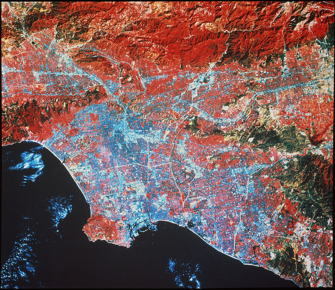
| Los Angeles. Infrared satellite image of the city of Los Angeles in California,USA,with the San Gabriel Mountains (at top) and the Santa Ana Mountains (at lower right). North is at top. In the infrared range,buildings are light blue and pink,green vegetation is shades of red,dry grasses and bare soil are yellow/green and water is black. At lower left is the city's airport. Los Angeles is the second largest city in the USA. Image taken by the American Landsat-5 satellite in October and covers an area of approximately 10,900 square kilometres (4280 square miles) | |
| Lizenzart: | Lizenzpflichtig |
| Credit: | Science Photo Library / Terranova International |
| Bildgröße: | 4062 px × 3528 px |
| Modell-Rechte: | nicht erforderlich |
| Eigentums-Rechte: | nicht erforderlich |
| Restrictions: |
|
Preise für dieses Bild ab 15 €
Universitäten & Organisationen
(Informationsmaterial Digital, Informationsmaterial Print, Lehrmaterial Digital etc.)
ab 15 €
Redaktionell
(Bücher, Bücher: Sach- und Fachliteratur, Digitale Medien (redaktionell) etc.)
ab 30 €
Werbung
(Anzeigen, Aussenwerbung, Digitale Medien, Fernsehwerbung, Karten, Werbemittel, Zeitschriften etc.)
ab 55 €
Handelsprodukte
(bedruckte Textilie, Kalender, Postkarte, Grußkarte, Verpackung etc.)
ab 75 €
Pauschalpreise
Rechtepakete für die unbeschränkte Bildnutzung in Print oder Online
ab 495 €