Earthquake Measuring Station
Bildnummer 12057405
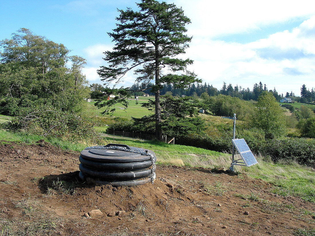
| A completed transportable array station on Lummi Island,Washington. The station will record earthquakes occurring locally,nationally and worldwide. Scientists will use the data to produce images of the Earth's interior and to produce new insights into the earthquake process. In a modern-day journey to the centre of the Earth,geologists are exploring the structure and evolution of the North American continent at scales from hundreds of kilometers to less than a millimeter,and from the structure of a continent,to individual faults,earthquakes and volcanoes. The project is called EarthScope. With approximately $200 million in funding from the National Science Foundation (NSF),EarthScope began development in 2004,and will continue over a five year period. It is expected to operate for an additional 15 years | |
| Lizenzart: | Lizenzpflichtig |
| Credit: | Science Photo Library / Science Source |
| Bildgröße: | 2272 px × 1704 px |
| Modell-Rechte: | nicht erforderlich |
| Eigentums-Rechte: | nicht erforderlich |
| Restrictions: |
|
Preise für dieses Bild ab 15 €
Universitäten & Organisationen
(Informationsmaterial Digital, Informationsmaterial Print, Lehrmaterial Digital etc.)
ab 15 €
Redaktionell
(Bücher, Bücher: Sach- und Fachliteratur, Digitale Medien (redaktionell) etc.)
ab 30 €
Werbung
(Anzeigen, Aussenwerbung, Digitale Medien, Fernsehwerbung, Karten, Werbemittel, Zeitschriften etc.)
ab 55 €
Handelsprodukte
(bedruckte Textilie, Kalender, Postkarte, Grußkarte, Verpackung etc.)
ab 75 €
Pauschalpreise
Rechtepakete für die unbeschränkte Bildnutzung in Print oder Online
ab 495 €