Map of the British Isles,18th century
Bildnummer 11947239
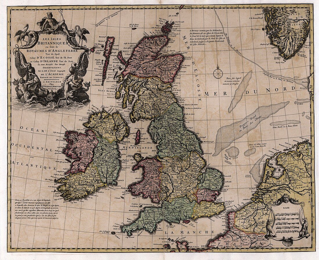
| Map of the British Isles. 18th-century map of the regions of the Kingdom of Great Britain and the Kingdom of Ireland,making up the British Isles. Ireland is divided into four provinces: Ulster,Connaught,Leinster and Munster. Scotland is divided into northern and southern halves. Wales is marked as a separate region,and England is divided into the North,the Midlands,the West,the East,and the South. The scale at bottom right gives distances in English,Scottish and Irish miles,as well as two historical French units: French leagues and French marine leagues. This map,by French cartographer Guillaume de L'Isle (1675-1726),was published in Amsterdam | |
| Lizenzart: | Lizenzpflichtig |
| Credit: | Science Photo Library / LIBRARY OF CONGRESS, Geography and Map Division |
| Bildgröße: | 4866 px × 3969 px |
| Modell-Rechte: | nicht erforderlich |
| Eigentums-Rechte: | nicht erforderlich |
| Restrictions: | - |
Preise für dieses Bild ab 15 €
Universitäten & Organisationen
(Informationsmaterial Digital, Informationsmaterial Print, Lehrmaterial Digital etc.)
ab 15 €
Redaktionell
(Bücher, Bücher: Sach- und Fachliteratur, Digitale Medien (redaktionell) etc.)
ab 30 €
Werbung
(Anzeigen, Aussenwerbung, Digitale Medien, Fernsehwerbung, Karten, Werbemittel, Zeitschriften etc.)
ab 55 €
Handelsprodukte
(bedruckte Textilie, Kalender, Postkarte, Grußkarte, Verpackung etc.)
ab 75 €
Pauschalpreise
Rechtepakete für die unbeschränkte Bildnutzung in Print oder Online
ab 495 €
Keywords
- 1700er Jahre,
- 18. Jahrhundert,
- Amsterdam,
- britisch,
- Britische Inseln,
- England,
- Englisch,
- Europa,
- europäisch,
- Französisch,
- geografisch,
- Geographie,
- Geschichte,
- Großbritannien,
- historisch,
- Illustration,
- Insel,
- Irisch,
- Irland,
- Karte,
- Kartographie,
- Kunstwerk,
- leinster,
- Maßstab,
- Nation,
- Nautisch,
- Niederländisch,
- Niemand,
- Nordsee,
- Provinz,
- schottisch,
- Schottland,
- Staat,
- Ulster,
- Wales,
- Walisisch