Map of the Americas,1660
Bildnummer 11946503
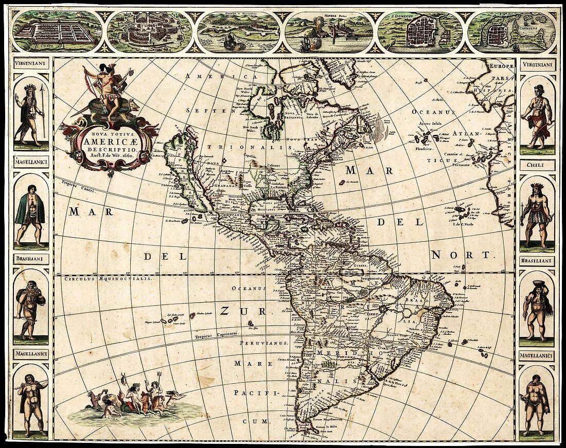
| Map of the Americas,titled 'Nova Totius Americae Descriptio' and produced in 1660 by by Dutch cartographer Frederick de Wit (c.1629-1706). The Atlantic and Pacific oceans,named in Latin,are also named as Mar del Zur (South Sea) and Mar del Nort (North Sea). North and South America are named in Latin as 'Septentrionalis' (northern) and 'Meridionalis' (southern). Indigenous peoples are shown from Virginia,Brazil,Chile and Patagonia (the 'Magellanici'). The cities across top are (left to right): Cusco (Peru),Mexico City (Mexico),Olinda in Pernambuco (Brazil),Havana (Cuba),Santo Domingo (Hispaniola) and Cartagena (Columbia) | |
| Lizenzart: | Lizenzpflichtig |
| Credit: | Science Photo Library / LIBRARY OF CONGRESS, Geography and Map Division |
| Bildgröße: | 5188 px × 4108 px |
| Modell-Rechte: | nicht erforderlich |
| Eigentums-Rechte: | nicht erforderlich |
| Restrictions: | - |
Preise für dieses Bild ab 15 €
Universitäten & Organisationen
(Informationsmaterial Digital, Informationsmaterial Print, Lehrmaterial Digital etc.)
ab 15 €
Redaktionell
(Bücher, Bücher: Sach- und Fachliteratur, Digitale Medien (redaktionell) etc.)
ab 30 €
Werbung
(Anzeigen, Aussenwerbung, Digitale Medien, Fernsehwerbung, Karten, Werbemittel, Zeitschriften etc.)
ab 55 €
Handelsprodukte
(bedruckte Textilie, Kalender, Postkarte, Grußkarte, Verpackung etc.)
ab 75 €
Pauschalpreise
Rechtepakete für die unbeschränkte Bildnutzung in Print oder Online
ab 495 €
Keywords
- 1600er Jahre,
- 17. Jahrhundert,
- Amerika,
- Atlantisch,
- Brasilien,
- cartagena,
- Chile,
- Chili,
- Columbia,
- Cusco,
- Dominikanische Republik,
- Einfarbig,
- geografisch,
- Geographie,
- Geschichte,
- Havanna,
- historisch,
- Illustration,
- Karte,
- Kartographie,
- Kontinent,
- Kuba,
- Kunstwerk,
- Land,
- Meer,
- Mexiko,
- Niederländisch,
- Niemand,
- Nordamerika,
- nordamerikanisch,
- Ozean,
- Ozeane,
- Pazifik,
- Peru,
- Santo Domingo,
- Schwarz und weiß,
- Stadt,
- Städte,
- Südamerika,
- Südamerikanisch,
- tribal,
- Virginia