Map of north-western Africa,1816
Bildnummer 11946486
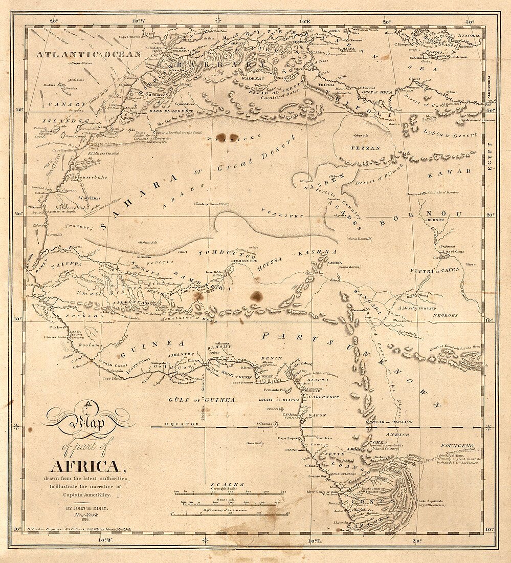
| Map of north-western Africa. 19th-century map of the north-western regions of Africa,illustrating the story of the August 1815 shipwreck of the crew of the US merchant ship 'Commerce'. 'Sufferings in Africa' (1817) by Captain James Riley (1777-1840) told of the crew's desert journey,captivity and arrival in Essaouira (Mogador,upper left). At the time,much of the African interior was poorly mapped. The most detailed knowledge was of the North African coast,along the Niger River (across centre) and around the mouth of the Congo River (lower right). Map published in 1816 in New York by US geographer John Hartshorne Eddy (1783-1817) | |
| Lizenzart: | Lizenzpflichtig |
| Credit: | Science Photo Library / LIBRARY OF CONGRESS, Geography and Map Division |
| Bildgröße: | 4003 px × 4408 px |
| Modell-Rechte: | nicht erforderlich |
| Eigentums-Rechte: | nicht erforderlich |
| Restrictions: | - |
Preise für dieses Bild ab 15 €
Universitäten & Organisationen
(Informationsmaterial Digital, Informationsmaterial Print, Lehrmaterial Digital etc.)
ab 15 €
Redaktionell
(Bücher, Bücher: Sach- und Fachliteratur, Digitale Medien (redaktionell) etc.)
ab 30 €
Werbung
(Anzeigen, Aussenwerbung, Digitale Medien, Fernsehwerbung, Karten, Werbemittel, Zeitschriften etc.)
ab 55 €
Handelsprodukte
(bedruckte Textilie, Kalender, Postkarte, Grußkarte, Verpackung etc.)
ab 75 €
Pauschalpreise
Rechtepakete für die unbeschränkte Bildnutzung in Print oder Online
ab 495 €
Keywords
- 1800er Jahre,
- 19. Jahrhundert,
- Abenteuer,
- Afrika,
- Afrikanisch,
- Einfarbig,
- Essaouira,
- Gefangenschaft,
- geografisch,
- Geographie,
- Geschichte,
- Golf von Guinea,
- Handel,
- historisch,
- Illustration,
- Innere,
- Kanarische Inseln,
- Karte,
- Kartographie,
- Kontinent,
- Kunstwerk,
- Marokko,
- Niemand,
- Nordafrika,
- Nordwest,
- Schwarz und weiß,
- Westafrika,
- Western,
- Wüste