Mayer's Moon map,1775
Bildnummer 11905190
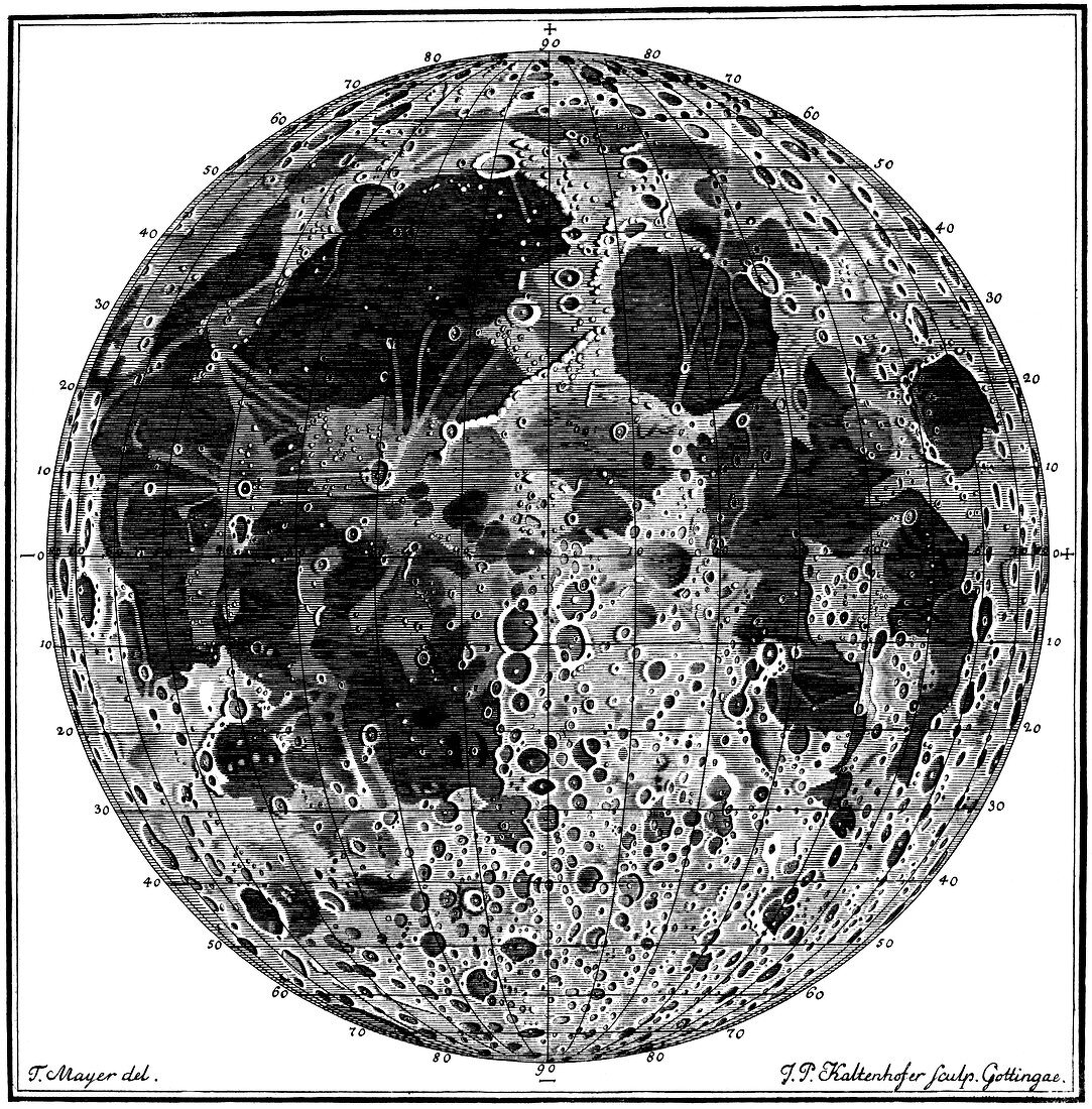
| Map of the Moon by the German astronomer Tobias Mayer (1723-1762),published in 1775 in Opera Indeita. The map is divided up into a co-ordinate system of longitude and latitude. The map shows the cratered highlands (light areas) and the lowland lunar maria (dark areas). The mapping of the Moon with telescopes started with Galileo in 1610,and then developed further during the 17th and 18th centuries as telescopes improved | |
| Lizenzart: | Lizenzpflichtig |
| Credit: | Science Photo Library / Royal Astronomical Society |
| Bildgröße: | 4193 px × 4259 px |
| Modell-Rechte: | nicht erforderlich |
| Eigentums-Rechte: | nicht erforderlich |
| Restrictions: | - |
Preise für dieses Bild ab 15 €
Universitäten & Organisationen
(Informationsmaterial Digital, Informationsmaterial Print, Lehrmaterial Digital etc.)
ab 15 €
Redaktionell
(Bücher, Bücher: Sach- und Fachliteratur, Digitale Medien (redaktionell) etc.)
ab 30 €
Werbung
(Anzeigen, Aussenwerbung, Digitale Medien, Fernsehwerbung, Karten, Werbemittel, Zeitschriften etc.)
ab 55 €
Handelsprodukte
(bedruckte Textilie, Kalender, Postkarte, Grußkarte, Verpackung etc.)
ab 75 €
Pauschalpreise
Rechtepakete für die unbeschränkte Bildnutzung in Print oder Online
ab 495 €