Mars map from 1881
Bildnummer 11904986
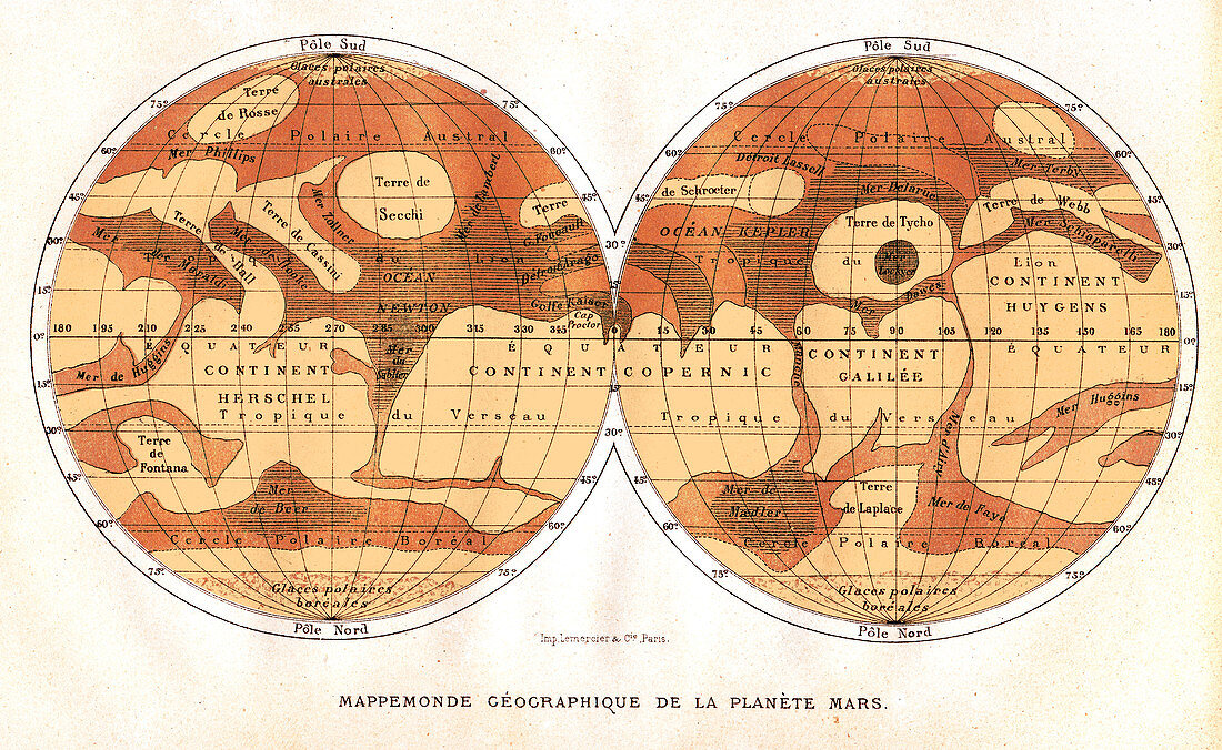
| Map of Mars,published in Paris in 1881. The first accurate telescope observations of Mars were made in 1877 and 1881 when Mars was at its closest to Earth (a situation called an opposition). The map (north at bottom) does show the dark and light areas thought to be seas and continents,but now known to be highlands (dark) and lowlands (light). The map features are named for famous astronomers. The Mer Sciaparelli (upper right) is now known as Valles Marineris,and Terre de Secchi (upper left) is an impact basin now named Hellas Planitia | |
| Lizenzart: | Lizenzpflichtig |
| Credit: | Science Photo Library / Van Ravenswaay, Detlev |
| Bildgröße: | 3520 px × 2162 px |
| Modell-Rechte: | nicht erforderlich |
| Eigentums-Rechte: | nicht erforderlich |
| Restrictions: | - |
Preise für dieses Bild ab 15 €
Universitäten & Organisationen
(Informationsmaterial Digital, Informationsmaterial Print, Lehrmaterial Digital etc.)
ab 15 €
Redaktionell
(Bücher, Bücher: Sach- und Fachliteratur, Digitale Medien (redaktionell) etc.)
ab 30 €
Werbung
(Anzeigen, Aussenwerbung, Digitale Medien, Fernsehwerbung, Karten, Werbemittel, Zeitschriften etc.)
ab 55 €
Handelsprodukte
(bedruckte Textilie, Kalender, Postkarte, Grußkarte, Verpackung etc.)
ab 75 €
Pauschalpreise
Rechtepakete für die unbeschränkte Bildnutzung in Print oder Online
ab 495 €
Keywords
- 19. Jahrhundert,
- Astronomie,
- astronomisch,
- Fernrohr,
- Französisch,
- geografisch,
- Geographie,
- Geschichte der Wissenschaft,
- hellas Planitia,
- Hemisphären,
- historisch,
- Karte,
- Kartographie,
- Kontinente,
- kreisförmig,
- Mars,
- Paris,
- Planet,
- planetarisch,
- Projektion,
- Raum,
- Sonnensystem,
- Universum,
- Valles Marineris,
- vom Mars