Solar eclipse paths
Bildnummer 11904980
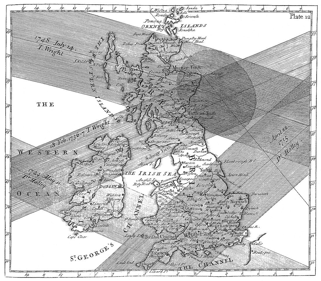
| Solar eclipse paths. Historical map of the paths of four solar eclipses over Great Britain during the 1700s. The map is from the book 'The use of globes',published by astronomer Thomas Wright (1711-1786),London in 1740. A total solar eclipse occurs when the Earth,moon and Sun are in direct alignment and the moon's shadow is cast on the Earth's surface. The shaded areas represent the path of the moving lunar shadow in April 1715,May 1724,February 1736 and July 1748. The oval shape (top right) shows the area under totality for the 1748 eclipse | |
| Lizenzart: | Lizenzpflichtig |
| Credit: | Science Photo Library / New York Public Library / Science, Industry & Business Library |
| Bildgröße: | 3775 px × 3306 px |
| Modell-Rechte: | nicht erforderlich |
| Eigentums-Rechte: | nicht erforderlich |
| Restrictions: | - |
Preise für dieses Bild ab 15 €
Universitäten & Organisationen
(Informationsmaterial Digital, Informationsmaterial Print, Lehrmaterial Digital etc.)
ab 15 €
Redaktionell
(Bücher, Bücher: Sach- und Fachliteratur, Digitale Medien (redaktionell) etc.)
ab 30 €
Werbung
(Anzeigen, Aussenwerbung, Digitale Medien, Fernsehwerbung, Karten, Werbemittel, Zeitschriften etc.)
ab 55 €
Handelsprodukte
(bedruckte Textilie, Kalender, Postkarte, Grußkarte, Verpackung etc.)
ab 75 €
Pauschalpreise
Rechtepakete für die unbeschränkte Bildnutzung in Print oder Online
ab 495 €