Diagram of magnetic dip on Earth
Bildnummer 11904725
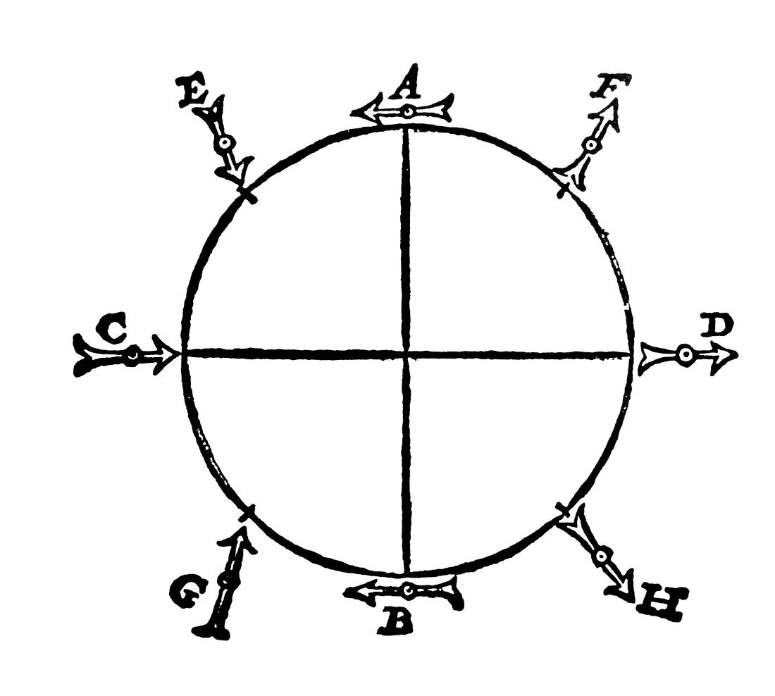
| Diagram of the Earth's magnetic field. Engraving showing the dip of the Earth's magnetic field at various latitudes,after the work of William Gilbert (1540-1603). In this picture,line AB is the equator,C is the North Magnetic Pole (Arctic) and D the South Magnetic Pole (Antarctic). The tip of the arrows are magnetic south,and the direction of the arrows indicates the direction a freely-rotating compass would point. To test the hypothesis,Gilbert used a special round lodestone called a terrela | |
| Lizenzart: | Lizenzpflichtig |
| Credit: | Science Photo Library |
| Bildgröße: | 4488 px × 4031 px |
| Modell-Rechte: | nicht erforderlich |
| Eigentums-Rechte: | nicht erforderlich |
| Restrictions: | - |
Preise für dieses Bild ab 15 €
Universitäten & Organisationen
(Informationsmaterial Digital, Informationsmaterial Print, Lehrmaterial Digital etc.)
ab 15 €
Redaktionell
(Bücher, Bücher: Sach- und Fachliteratur, Digitale Medien (redaktionell) etc.)
ab 30 €
Werbung
(Anzeigen, Aussenwerbung, Digitale Medien, Fernsehwerbung, Karten, Werbemittel, Zeitschriften etc.)
ab 55 €
Handelsprodukte
(bedruckte Textilie, Kalender, Postkarte, Grußkarte, Verpackung etc.)
ab 75 €
Pauschalpreise
Rechtepakete für die unbeschränkte Bildnutzung in Print oder Online
ab 495 €