Mapping water mains
Bildnummer 11900480
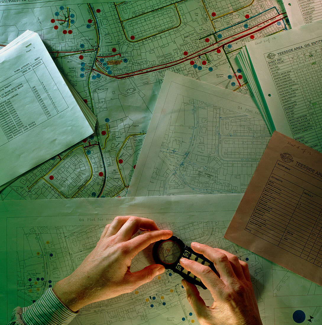
| Water mains mapping. Hands using a device to send the coordinates of water mains on a street map to a Geographic Information System (GIS). A GIS is a computer system on which geographical data can be inputted,stored,manipulated and displayed. This aids the water company's management of the water system,as well as improving the efficiency with which improvements and repairs may be carried out | |
| Lizenzart: | Lizenzpflichtig |
| Credit: | Science Photo Library / Cuthbert, Colin |
| Bildgröße: | 3506 px × 3543 px |
| Modell-Rechte: | nicht erforderlich |
| Eigentums-Rechte: | nicht erforderlich |
| Restrictions: | - |
Preise für dieses Bild ab 15 €
Universitäten & Organisationen
(Informationsmaterial Digital, Informationsmaterial Print, Lehrmaterial Digital etc.)
ab 15 €
Redaktionell
(Bücher, Bücher: Sach- und Fachliteratur, Digitale Medien (redaktionell) etc.)
ab 30 €
Werbung
(Anzeigen, Aussenwerbung, Digitale Medien, Fernsehwerbung, Karten, Werbemittel, Zeitschriften etc.)
ab 55 €
Handelsprodukte
(bedruckte Textilie, Kalender, Postkarte, Grußkarte, Verpackung etc.)
ab 75 €
Pauschalpreise
Rechtepakete für die unbeschränkte Bildnutzung in Print oder Online
ab 495 €