Virtual reality landscape
Bildnummer 11896631
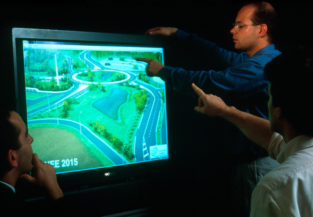
| Virtual reality landscape. Computer presentation of a virtual reality (VR) road network. This realistic model allows the potential development to be more easily assessed before being built. The VR system is based on AMAP,plant-modelling software developed by CIRAD,an international centre for agronomical research in France | |
| Lizenzart: | Lizenzpflichtig |
| Credit: | Science Photo Library / Raguet, Hubert / EURELIOS |
| Bildgröße: | 3579 px × 2480 px |
| Modell-Rechte: | Derzeit liegt noch kein Release vor. Bitte kontaktieren Sie uns vor Verwendung. |
| Eigentums-Rechte: | nicht erforderlich |
| Restrictions: |
|
Preise für dieses Bild ab 15 €
Universitäten & Organisationen
(Informationsmaterial Digital, Informationsmaterial Print, Lehrmaterial Digital etc.)
ab 15 €
Redaktionell
(Bücher, Bücher: Sach- und Fachliteratur, Digitale Medien (redaktionell) etc.)
ab 30 €
Werbung
(Anzeigen, Aussenwerbung, Digitale Medien, Fernsehwerbung, Karten, Werbemittel, Zeitschriften etc.)
ab 55 €
Handelsprodukte
(bedruckte Textilie, Kalender, Postkarte, Grußkarte, Verpackung etc.)
ab 75 €
Pauschalpreise
Rechtepakete für die unbeschränkte Bildnutzung in Print oder Online
ab 495 €