Radar image of Chernobyl site and surroundings
Bildnummer 11891757
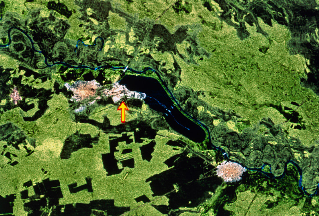
| Chernobyl. Coloured radar image of the area around the Chernobyl nuclear power facility,Ukraine. The large blue area at centre is the power station's 12km-long cooling pond,fed by the River Pripyat. The power station complex is at the left end of the pond. The arrow points to the site of the four RBMK-type nuclear reactors. One of these reactors overheated and suffered a meltdown and then exploded on 26 April 1986. An exclusion zone of 30km radius around the site includes the town of Chernobyl (lower right) and Tostyy-Les (centre left). This image was gathered by the second Space Radar Laboratory (SRL-2) during Shuttle Mission STS-68 of 30 September to 11 October 1994 | |
| Lizenzart: | Lizenzpflichtig |
| Credit: | Science Photo Library / NASA |
| Bildgröße: | 4939 px × 3339 px |
| Modell-Rechte: | nicht erforderlich |
| Eigentums-Rechte: | nicht erforderlich |
| Restrictions: | - |
Preise für dieses Bild ab 15 €
Universitäten & Organisationen
(Informationsmaterial Digital, Informationsmaterial Print, Lehrmaterial Digital etc.)
ab 15 €
Redaktionell
(Bücher, Bücher: Sach- und Fachliteratur, Digitale Medien (redaktionell) etc.)
ab 30 €
Werbung
(Anzeigen, Aussenwerbung, Digitale Medien, Fernsehwerbung, Karten, Werbemittel, Zeitschriften etc.)
ab 55 €
Handelsprodukte
(bedruckte Textilie, Kalender, Postkarte, Grußkarte, Verpackung etc.)
ab 75 €
Pauschalpreise
Rechtepakete für die unbeschränkte Bildnutzung in Print oder Online
ab 495 €