ERS-1 satellite over the coast of Holland
Bildnummer 11889146
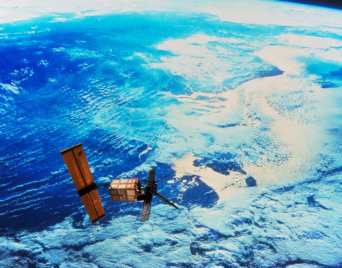
| European Remote-Sensing Satellite. Composite image of the European Remote-Sensing Satellite (ERS-1) over the coast of the Netherlands. North is at bottom right. At lower centre is the province of Friesland and the peninsula of Walcheren is at centre. ERS-1 has three all-weather instruments,taking measurements in the infrared,microwave and radar wavelengths. ERS-1 monitors shorelines,ocean currents and the sea surface. It can also be used to study the growth of crops,map the extent of the polar icecaps and detect oil spills | |
| Lizenzart: | Lizenzpflichtig |
| Credit: | Science Photo Library / ESA |
| Bildgröße: | 4008 px × 3143 px |
| Modell-Rechte: | nicht erforderlich |
| Eigentums-Rechte: | nicht erforderlich |
| Restrictions: |
|
Preise für dieses Bild ab 15 €
Universitäten & Organisationen
(Informationsmaterial Digital, Informationsmaterial Print, Lehrmaterial Digital etc.)
ab 15 €
Redaktionell
(Bücher, Bücher: Sach- und Fachliteratur, Digitale Medien (redaktionell) etc.)
ab 30 €
Werbung
(Anzeigen, Aussenwerbung, Digitale Medien, Fernsehwerbung, Karten, Werbemittel, Zeitschriften etc.)
ab 55 €
Handelsprodukte
(bedruckte Textilie, Kalender, Postkarte, Grußkarte, Verpackung etc.)
ab 75 €
Pauschalpreise
Rechtepakete für die unbeschränkte Bildnutzung in Print oder Online
ab 495 €