ERS-1 satellite in orbit over earth
Bildnummer 11889138
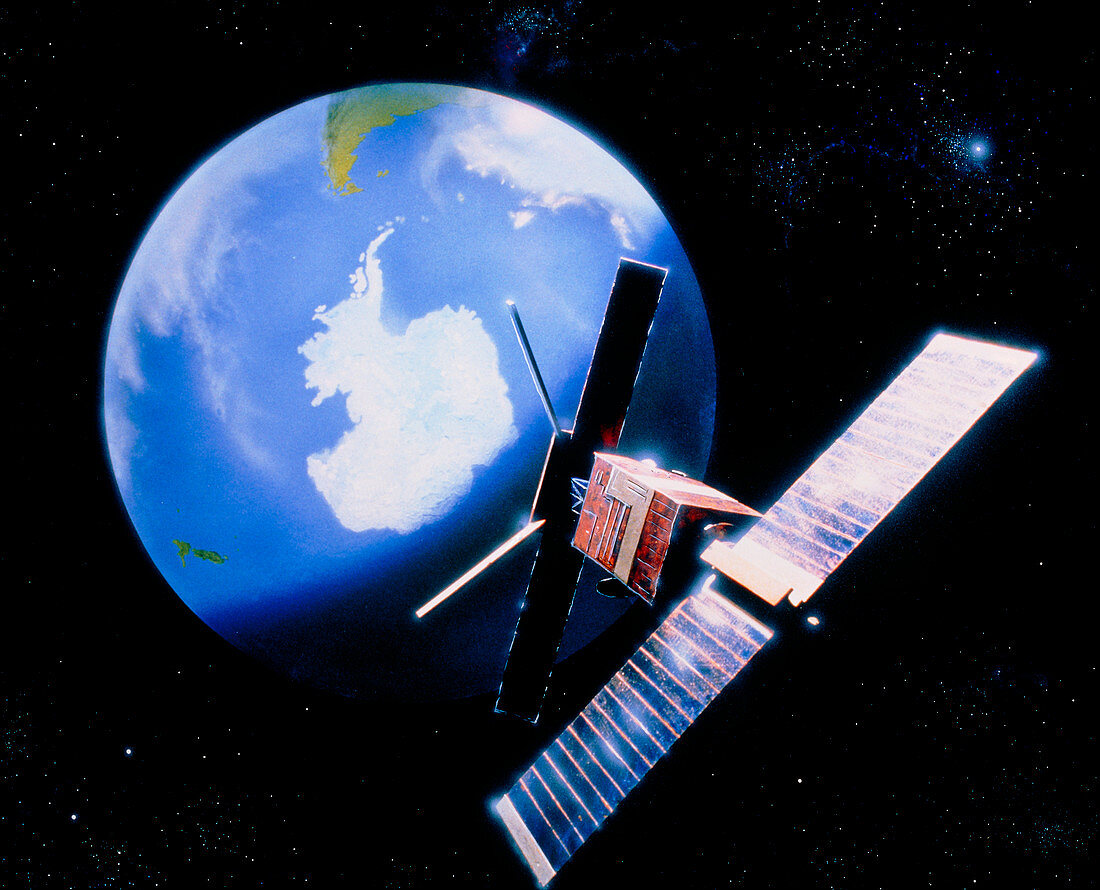
| Artist's impression of the European Remote-sensing Satellite (ERS-1) in orbit over the south pole. Due for launch in April 1991,ERS-1 is equipped with all-weather microwave and radar instruments which will be used primarily to study coastal,ocean and polar ice processes. The picture shows ERS-1's solar panels at right and its long Synthetic Aperture Radar antenna facing the Earth. ERS-1 will play a major role in international satellite investigations into climate change,the so-called "Mission to Planet Earth". It will map ocean waves,currents and tides; global sea- surface temperatures and winds; ocean floor topography and sea ice distribution | |
| Lizenzart: | Lizenzpflichtig |
| Credit: | Science Photo Library / Baum, Julian |
| Bildgröße: | 4701 px × 3805 px |
| Modell-Rechte: | nicht erforderlich |
| Eigentums-Rechte: | nicht erforderlich |
| Restrictions: | - |
Preise für dieses Bild ab 15 €
Universitäten & Organisationen
(Informationsmaterial Digital, Informationsmaterial Print, Lehrmaterial Digital etc.)
ab 15 €
Redaktionell
(Bücher, Bücher: Sach- und Fachliteratur, Digitale Medien (redaktionell) etc.)
ab 30 €
Werbung
(Anzeigen, Aussenwerbung, Digitale Medien, Fernsehwerbung, Karten, Werbemittel, Zeitschriften etc.)
ab 55 €
Handelsprodukte
(bedruckte Textilie, Kalender, Postkarte, Grußkarte, Verpackung etc.)
ab 75 €
Pauschalpreise
Rechtepakete für die unbeschränkte Bildnutzung in Print oder Online
ab 495 €