Radio map of the whole sky showing Milky Way
Bildnummer 11886226
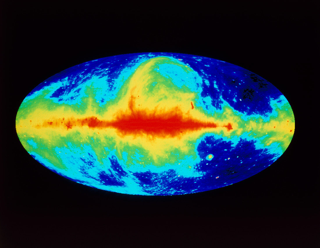
| Radio map of whole sky and our Milky Way galaxy. Computer-processed radio map of the whole sky at the 73 cm wavelength. Intensity of radio emission is coded from red (maximum emission) through yellow,green & blue to black. The red horizontal band is the plane of our galaxy. The loop of emission at centre top is the North Polar Spur. The projection used is a normal way of looking at the outside of a sphere,such as Earth; but here we are at the centre of the sphere and looking at the universe all around us. The map was made with data from Jodrell Bank,Effelsberg & Parkes radio telescopes in England,Germany and Australia | |
| Lizenzart: | Lizenzpflichtig |
| Credit: | Science Photo Library / MAX-PLANCK-INSTITUT FUR RADIOASTRONOMIE |
| Bildgröße: | 4969 px × 3847 px |
| Modell-Rechte: | nicht erforderlich |
| Eigentums-Rechte: | nicht erforderlich |
| Restrictions: | - |
Preise für dieses Bild ab 15 €
Universitäten & Organisationen
(Informationsmaterial Digital, Informationsmaterial Print, Lehrmaterial Digital etc.)
ab 15 €
Redaktionell
(Bücher, Bücher: Sach- und Fachliteratur, Digitale Medien (redaktionell) etc.)
ab 30 €
Werbung
(Anzeigen, Aussenwerbung, Digitale Medien, Fernsehwerbung, Karten, Werbemittel, Zeitschriften etc.)
ab 55 €
Handelsprodukte
(bedruckte Textilie, Kalender, Postkarte, Grußkarte, Verpackung etc.)
ab 75 €
Pauschalpreise
Rechtepakete für die unbeschränkte Bildnutzung in Print oder Online
ab 495 €