Chasma Boreale canyon,satellite image
Bildnummer 11882482
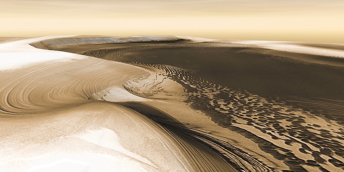
| Chasma Boreale. Satellite image of a the Chasma Boreale,a deep canyon that cuts into the raised piece of land known as Planum Boreum in Mars' north polar region. The canyon extends for 570 kilometres into the ice cap,is up to 100 kilometres wide and features scarps up to 2 kilometres high. This image was generated using data from the Mars Odyssey spacecraft,which is in orbit around Mars | |
| Lizenzart: | Lizenzpflichtig |
| Credit: | Science Photo Library / NASA |
| Bildgröße: | 5929 px × 2965 px |
| Modell-Rechte: | nicht erforderlich |
| Eigentums-Rechte: | nicht erforderlich |
| Restrictions: | - |
Preise für dieses Bild ab 15 €
Universitäten & Organisationen
(Informationsmaterial Digital, Informationsmaterial Print, Lehrmaterial Digital etc.)
ab 15 €
Redaktionell
(Bücher, Bücher: Sach- und Fachliteratur, Digitale Medien (redaktionell) etc.)
ab 30 €
Werbung
(Anzeigen, Aussenwerbung, Digitale Medien, Fernsehwerbung, Karten, Werbemittel, Zeitschriften etc.)
ab 55 €
Handelsprodukte
(bedruckte Textilie, Kalender, Postkarte, Grußkarte, Verpackung etc.)
ab 75 €
Pauschalpreise
Rechtepakete für die unbeschränkte Bildnutzung in Print oder Online
ab 495 €
Keywords
- 21. Jahrhundert,
- Chasma Boreale,
- Felsen,
- Felsig,
- Gebogen,
- Geographie,
- Geologie,
- geologisch,
- Gletscherspalte,
- Klippe,
- Klippen,
- Kohlendioxid,
- Mars,
- Nordpol,
- Oberfläche,
- Planet,
- planetarisch,
- Planetenwissenschaft,
- polar,
- Raum,
- Satellit,
- Schlucht,
- Schluchten,
- Sonnensystem,
- Tal,
- Täler,
- Tief,
- topografisch,
- Topographie,
- topographisch,
- vom Mars,
- Wasser,
- Weltall