Fluvial erosion on Mars
Bildnummer 11882460
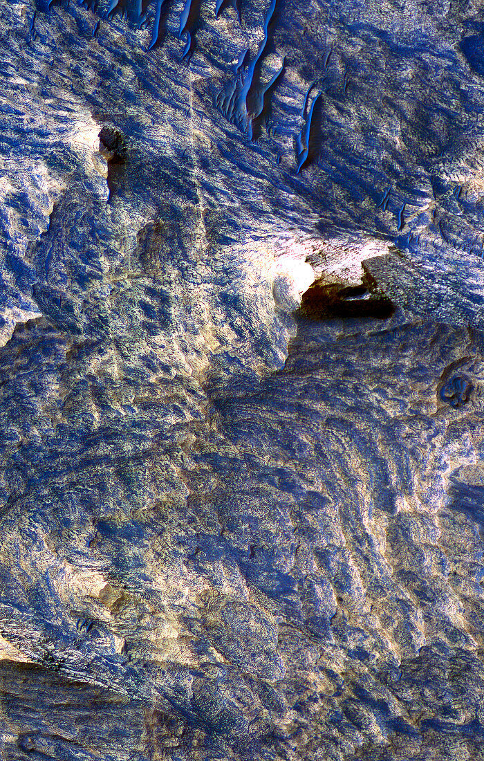
| Fluvial erosion on Mars. Colour enhanced satellite image of the Candor Chasma region of the Valles Marineris canyon. It is thought that this canyon initially formed as the result of tectonic fracturing of the upper crust of Mars. The fractures,or joints,are visible as approximately vertical thin blue lines bordered by yellow areas (upper left to lower left). The yellow areas are halos,interpreted as areas of rock that have been chemically altered by fluid flowing through the joints. This image was obtained by the High Resolution Imaging Science Experiment (HiRise) camera on board the Mars Reconnaissance Orbiter,September 30th,2006 | |
| Lizenzart: | Lizenzpflichtig |
| Credit: | Science Photo Library / NASA / JPL / University of Arizona |
| Bildgröße: | 2381 px × 3743 px |
| Modell-Rechte: | nicht erforderlich |
| Eigentums-Rechte: | nicht erforderlich |
| Restrictions: | - |
Preise für dieses Bild ab 15 €
Universitäten & Organisationen
(Informationsmaterial Digital, Informationsmaterial Print, Lehrmaterial Digital etc.)
ab 15 €
Redaktionell
(Bücher, Bücher: Sach- und Fachliteratur, Digitale Medien (redaktionell) etc.)
ab 30 €
Werbung
(Anzeigen, Aussenwerbung, Digitale Medien, Fernsehwerbung, Karten, Werbemittel, Zeitschriften etc.)
ab 55 €
Handelsprodukte
(bedruckte Textilie, Kalender, Postkarte, Grußkarte, Verpackung etc.)
ab 75 €
Pauschalpreise
Rechtepakete für die unbeschränkte Bildnutzung in Print oder Online
ab 495 €
Keywords
- 21. Jahrhundert,
- Astronomie,
- Erosion,
- farbig,
- Fraktur,
- Frakturen,
- gefärbt,
- Gelenk,
- Gelenke,
- Geologie,
- geologisch,
- Geomorphologie,
- Grat,
- HiRISE,
- hochauflösende Bildgebung,
- Hydrologie,
- Joint,
- Kosmologie,
- Mars,
- MRO,
- NASA,
- Planet,
- planetarisch,
- Planetenwissenschaft,
- Raum,
- Satellit,
- Satellitenbild,
- Schichten,
- Schlucht,
- September,
- Sonnensystem,
- Tal,
- Valles Marineris,
- vom Mars,
- Wasser,
- Weltall,
- Wissenschaft