Venus,radar map
Bildnummer 11881756
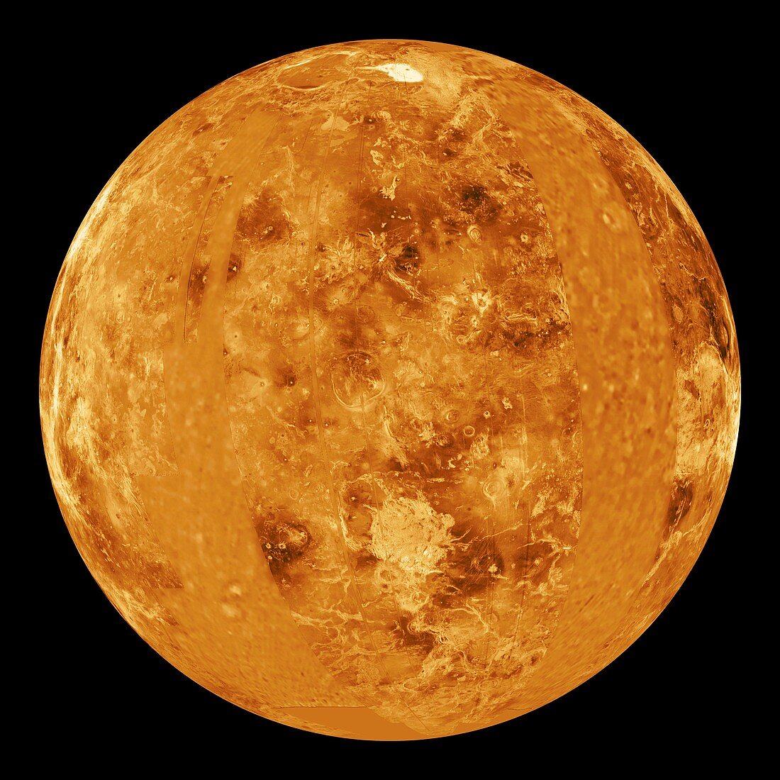
| Venus. Synthetic aperture radar map of a hemisphere of Venus centred on the prime meridian (0 degrees longitude). The shading indicates the elevation of the surface relative to the mean planetary radius (6041 kilometres),from dark (valleys) to white (mountains). Near the top of the frame is an upland 'continent' called Ishtar Terra,featuring Maxwell Montes,the largest mountain on Venus. The map was created using data gathered by the Magellan radar-mapping spacecraft | |
| Lizenzart: | Lizenzpflichtig |
| Credit: | Science Photo Library / NASA / JPL |
| Bildgröße: | 4191 px × 4191 px |
| Modell-Rechte: | nicht erforderlich |
| Eigentums-Rechte: | nicht erforderlich |
| Restrictions: | - |
Preise für dieses Bild ab 15 €
Universitäten & Organisationen
(Informationsmaterial Digital, Informationsmaterial Print, Lehrmaterial Digital etc.)
ab 15 €
Redaktionell
(Bücher, Bücher: Sach- und Fachliteratur, Digitale Medien (redaktionell) etc.)
ab 30 €
Werbung
(Anzeigen, Aussenwerbung, Digitale Medien, Fernsehwerbung, Karten, Werbemittel, Zeitschriften etc.)
ab 55 €
Handelsprodukte
(bedruckte Textilie, Kalender, Postkarte, Grußkarte, Verpackung etc.)
ab 75 €
Pauschalpreise
Rechtepakete für die unbeschränkte Bildnutzung in Print oder Online
ab 495 €
Keywords
- 1990er Jahre,
- 20. Jahrhundert,
- ausgeschnitten,
- Berg,
- Berge,
- einer,
- Geographie,
- Geologie,
- geologisch,
- Ischtar Terra,
- Karte,
- Kontinent,
- Kreis,
- kreisförmig,
- Magellan Raumschiff,
- Magellansonde,
- Mosaik-,
- Planet,
- planetarisch,
- Planetenwissenschaft,
- Raum,
- rund,
- Satellit,
- Single,
- Sonnensystem,
- Tal,
- Täler,
- topografisch,
- Topographie,
- topographisch,
- Venus,
- Wissenschaft,
- Zusammengesetzt