False-colour Magellan mosaic of Venus w.hemisphere
Bildnummer 11881735
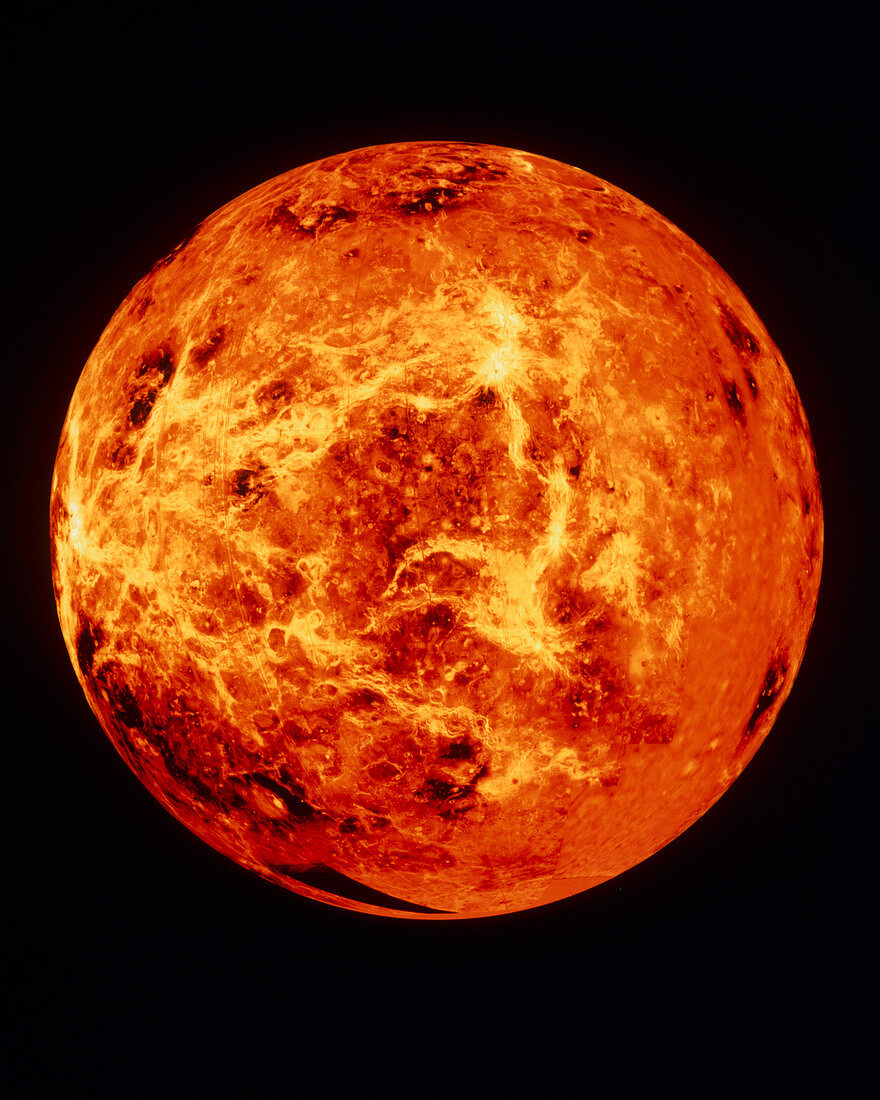
| False-colour radar map of the west hemisphere of Venus. The image is centered on the equator at 270 degrees east (90 degrees west) longitude,with the north pole at top. Four major radar-bright upland features are seen. Running down the image just right of centre are Beta Regio (top),Phoebe Regio and the less-distinct Themis Regio (bottom). The bright area at centre left is the eastern extent of the continent Aphrodite Terra. The data for this image were gathered by the Magellan radar- mapping spacecraft. Areas of missing Magellan data have been filled in with lower-resolution Pioneer- Venus data. The colour was suggested by Soviet photographic data | |
| Lizenzart: | Lizenzpflichtig |
| Credit: | Science Photo Library / NASA |
| Bildgröße: | 4110 px × 5135 px |
| Modell-Rechte: | nicht erforderlich |
| Eigentums-Rechte: | nicht erforderlich |
| Restrictions: | - |
Preise für dieses Bild ab 15 €
Universitäten & Organisationen
(Informationsmaterial Digital, Informationsmaterial Print, Lehrmaterial Digital etc.)
ab 15 €
Redaktionell
(Bücher, Bücher: Sach- und Fachliteratur, Digitale Medien (redaktionell) etc.)
ab 30 €
Werbung
(Anzeigen, Aussenwerbung, Digitale Medien, Fernsehwerbung, Karten, Werbemittel, Zeitschriften etc.)
ab 55 €
Handelsprodukte
(bedruckte Textilie, Kalender, Postkarte, Grußkarte, Verpackung etc.)
ab 75 €
Pauschalpreise
Rechtepakete für die unbeschränkte Bildnutzung in Print oder Online
ab 495 €