Pioneer-Venus radar map of the surface of Venus
Bildnummer 11881701
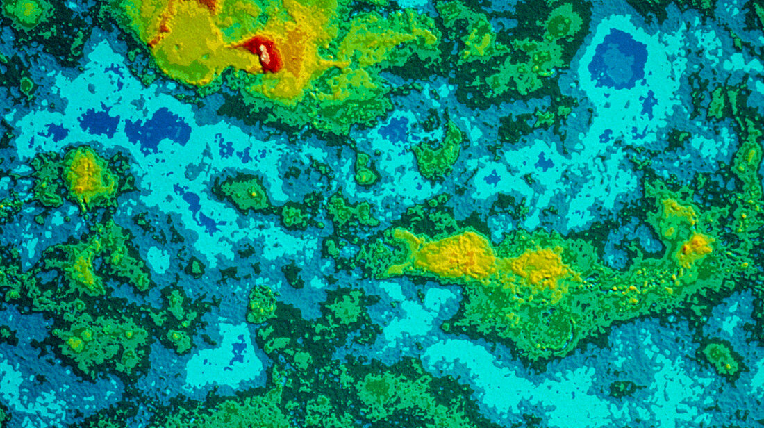
| Colour-coded topographic map of the surface of Venus,compiled from radar data recorded by the Pioneer-Venus spacecraft. Most of the planet's surface is covered by relatively smooth plains,coloured blue in this image. Several large highland regions are visible (yellow). The largest of these (top) is Ishtar Terra,a "continent" about the size of Australia. At lower right is Aphrodite Terra,and at lower left a line of three highland regions; Beta Regio (top),Phoebe Regio (centre) & Themis Regio (bottom). In the centre of Ishtar Terra are the Maxwell Montes (red & white),the highest mountains on Venus | |
| Lizenzart: | Lizenzpflichtig |
| Credit: | Science Photo Library / NASA |
| Bildgröße: | 4961 px × 2779 px |
| Modell-Rechte: | nicht erforderlich |
| Eigentums-Rechte: | nicht erforderlich |
| Restrictions: | - |
Preise für dieses Bild ab 15 €
Universitäten & Organisationen
(Informationsmaterial Digital, Informationsmaterial Print, Lehrmaterial Digital etc.)
ab 15 €
Redaktionell
(Bücher, Bücher: Sach- und Fachliteratur, Digitale Medien (redaktionell) etc.)
ab 30 €
Werbung
(Anzeigen, Aussenwerbung, Digitale Medien, Fernsehwerbung, Karten, Werbemittel, Zeitschriften etc.)
ab 55 €
Handelsprodukte
(bedruckte Textilie, Kalender, Postkarte, Grußkarte, Verpackung etc.)
ab 75 €
Pauschalpreise
Rechtepakete für die unbeschränkte Bildnutzung in Print oder Online
ab 495 €