Global topographic map of Venus
Bildnummer 11881698
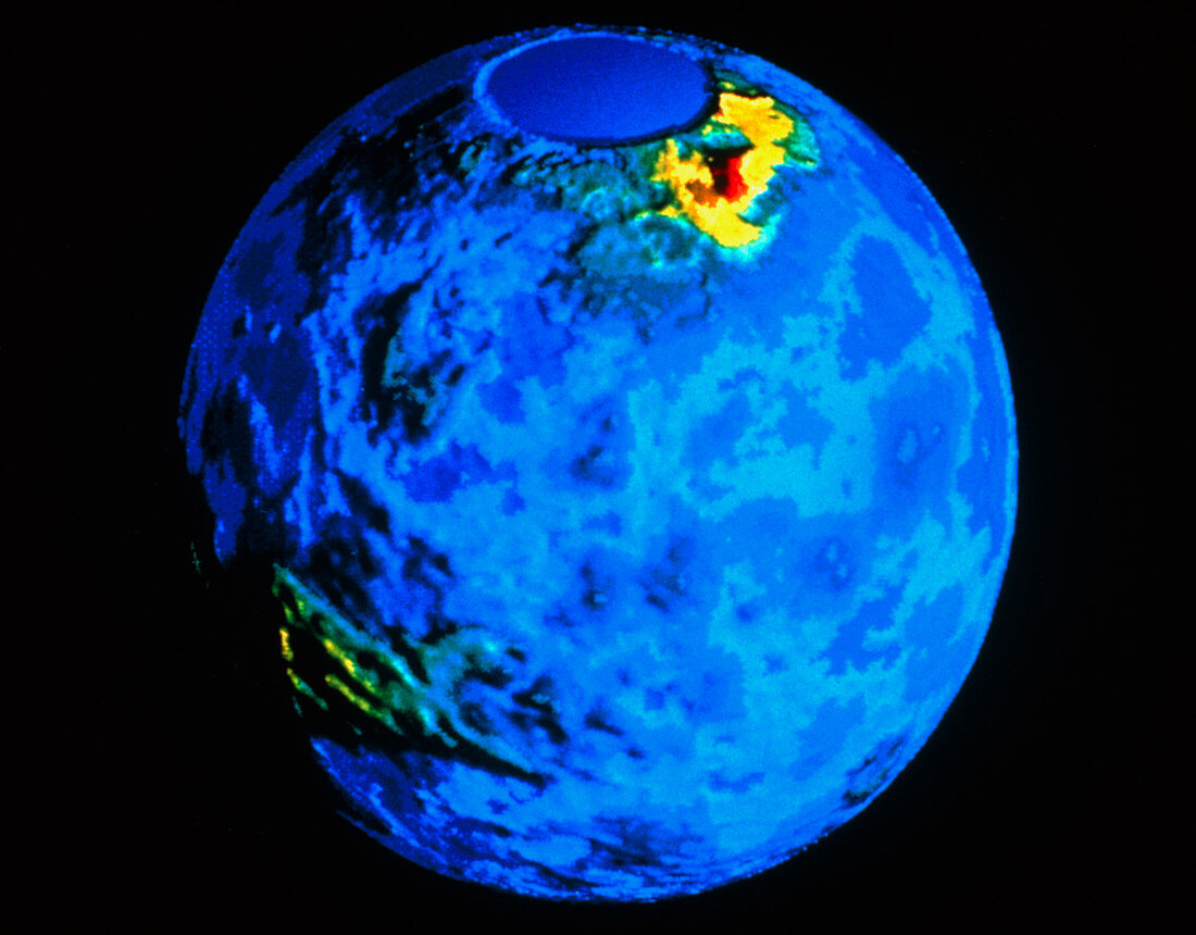
| Colour-coded topographic map of the surface of Venus,compiled from radar data recorded by the Pioneer-Venus spacecraft. The smooth circle at top marks the north pole,an area not mapped by the spacecraft. Most of the planet's surface is covered by relatively smooth plains,coloured blue in this image. Two large highland regions are visible (yellow),Ishtar Terra (upper left) and Aphrodite Terra (lower right). Ishtar Terra is a "continent" about the size of Australia,containing the Maxwell Montes (red),the highest mountains on Venus | |
| Lizenzart: | Lizenzpflichtig |
| Credit: | Science Photo Library / NASA |
| Bildgröße: | 4489 px × 3509 px |
| Modell-Rechte: | nicht erforderlich |
| Eigentums-Rechte: | nicht erforderlich |
| Restrictions: | - |
Preise für dieses Bild ab 15 €
Universitäten & Organisationen
(Informationsmaterial Digital, Informationsmaterial Print, Lehrmaterial Digital etc.)
ab 15 €
Redaktionell
(Bücher, Bücher: Sach- und Fachliteratur, Digitale Medien (redaktionell) etc.)
ab 30 €
Werbung
(Anzeigen, Aussenwerbung, Digitale Medien, Fernsehwerbung, Karten, Werbemittel, Zeitschriften etc.)
ab 55 €
Handelsprodukte
(bedruckte Textilie, Kalender, Postkarte, Grußkarte, Verpackung etc.)
ab 75 €
Pauschalpreise
Rechtepakete für die unbeschränkte Bildnutzung in Print oder Online
ab 495 €