Paris Observatory,France
Bildnummer 11879661
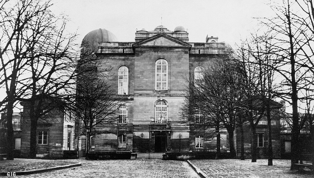
| Paris Observatory. The observatory,completed in 1672,was funded by King Louis XIV to extend France's maritime power and international trade. In 1672,its director Giovanni Cassini discovered four satellites of Saturn and a division in the planet's rings. He also measured the distance to Mars. In 1863,the observatory published the first modern weather maps and in 1887 began the Carte du Ciel (Map of the Sky) project,an international effort to map the positions of millions of stars,which was superseded by modern astronomical techniques before it could be finished. In 1913,the Paris Observatory used the Eiffel Tower as an antenna and exchanged radio signals with the US Naval Observatory to determine the exact distance of longitude between the two institutions | |
| Lizenzart: | Lizenzpflichtig |
| Credit: | Science Photo Library / Royal Astronomical Society |
| Bildgröße: | 5906 px × 3351 px |
| Modell-Rechte: | nicht erforderlich |
| Eigentums-Rechte: | nicht erforderlich |
| Restrictions: | - |
Preise für dieses Bild ab 15 €
Universitäten & Organisationen
(Informationsmaterial Digital, Informationsmaterial Print, Lehrmaterial Digital etc.)
ab 15 €
Redaktionell
(Bücher, Bücher: Sach- und Fachliteratur, Digitale Medien (redaktionell) etc.)
ab 30 €
Werbung
(Anzeigen, Aussenwerbung, Digitale Medien, Fernsehwerbung, Karten, Werbemittel, Zeitschriften etc.)
ab 55 €
Handelsprodukte
(bedruckte Textilie, Kalender, Postkarte, Grußkarte, Verpackung etc.)
ab 75 €
Pauschalpreise
Rechtepakete für die unbeschränkte Bildnutzung in Print oder Online
ab 495 €
Keywords
- 1600er Jahre,
- 17. Jahrhundert,
- Astronomie,
- astronomisch,
- Einfarbig,
- erst,
- Europa,
- europäisch,
- Frankreich,
- Französisch,
- Gebäude,
- Geschichte,
- Geschichte der Wissenschaft,
- Giovanni Cassini,
- historisch,
- International,
- Karten,
- Kuppel,
- Kuppeln,
- Observation,
- Observatorium,
- Paris,
- Pariser Observatorium,
- Programm,
- Projekt,
- Schwarz und weiß,
- Versuch