Blind person with GPS navigation system
Bildnummer 11846214
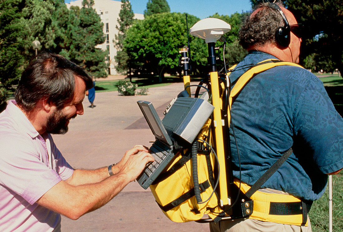
| Navigation aid for the blind. Blind man Reginald Golledge (right) and researcher Jack Loomis with the Personal Guidance System,an electronic navigation aid for blind people. The position of the user is determined by a GPS satellite receiver,and the direction in which they are facing by an electronic compass. These data are compared with a digital map in a computer,which calculates the position of landmarks relative to the user and synthesizes a word (eg 'Library') for each. These are fed into stereo earphones so the user can hear them coming from the correct relative locations. This system was developed at the University of California at Santa Barbara | |
| Lizenzart: | Lizenzpflichtig |
| Credit: | Science Photo Library / Morgan, Hank |
| Bildgröße: | 5132 px × 3475 px |
| Modell-Rechte: | Derzeit liegt noch kein Release vor. Bitte kontaktieren Sie uns vor Verwendung. |
| Eigentums-Rechte: | nicht erforderlich |
| Restrictions: |
|
Preise für dieses Bild ab 15 €
Universitäten & Organisationen
(Informationsmaterial Digital, Informationsmaterial Print, Lehrmaterial Digital etc.)
ab 15 €
Redaktionell
(Bücher, Bücher: Sach- und Fachliteratur, Digitale Medien (redaktionell) etc.)
ab 30 €
Werbung
(Anzeigen, Aussenwerbung, Digitale Medien, Fernsehwerbung, Karten, Werbemittel, Zeitschriften etc.)
ab 55 €
Handelsprodukte
(bedruckte Textilie, Kalender, Postkarte, Grußkarte, Verpackung etc.)
ab 75 €
Pauschalpreise
Rechtepakete für die unbeschränkte Bildnutzung in Print oder Online
ab 495 €