Geoforensic map
Bildnummer 11826357
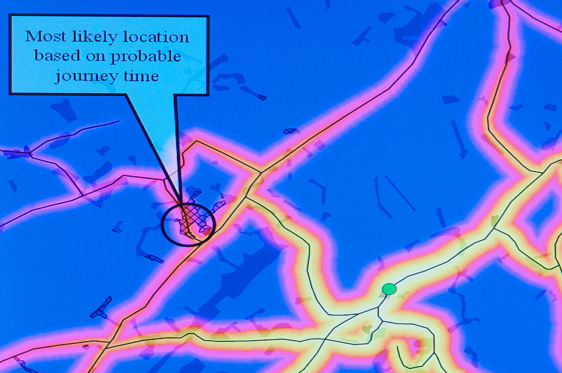
| Geoforensic map. This computer generated map shows soil and vegetation type overlaid onto a standard Ordnance Survey map of the region surrounding Edinburgh,UK. It applies data from the chemical analysis of a suspect's soil sample and matches it with a geographical database. The black lines indicate roads and a sign (centre) indicates the most likely location of the soil sample. This evidence can be used to trace the movements of a suspect in relation to the crime. The software and database that produces the geoforensic map is known as SoilFit. Photographed at the Macaulay Institute,Aberdeen,UK | |
| Lizenzart: | Lizenzpflichtig |
| Credit: | Science Photo Library / Murray, Louise |
| Bildgröße: | 4296 px × 2852 px |
| Modell-Rechte: | nicht erforderlich |
| Eigentums-Rechte: | nicht erforderlich |
| Restrictions: | - |
Preise für dieses Bild ab 15 €
Universitäten & Organisationen
(Informationsmaterial Digital, Informationsmaterial Print, Lehrmaterial Digital etc.)
ab 15 €
Redaktionell
(Bücher, Bücher: Sach- und Fachliteratur, Digitale Medien (redaktionell) etc.)
ab 30 €
Werbung
(Anzeigen, Aussenwerbung, Digitale Medien, Fernsehwerbung, Karten, Werbemittel, Zeitschriften etc.)
ab 55 €
Handelsprodukte
(bedruckte Textilie, Kalender, Postkarte, Grußkarte, Verpackung etc.)
ab 75 €
Pauschalpreise
Rechtepakete für die unbeschränkte Bildnutzung in Print oder Online
ab 495 €