Geoforensic map
Bildnummer 11826355
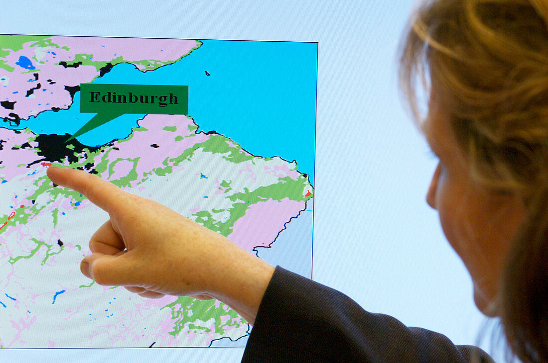
| Geoforensic map. Researcher Dr Lorna Dawson pointing at a geoforensic map. This computer generated map shows soil and vegetation type overlaid onto a standard Ordnance Survey map of the region surrounding Edinburgh,UK. It applies data from the chemical analysis of a soil sample and matches it with a geographical database. The map reveals areas where the soil sample matches the soil acidity and clay type (pink),areas where the mineral hornblende is present (red),areas where pine wood and local soil type matches (green). This evidence can be used to trace the movements of a suspect in relation to the crime. The software and database system that generates the geoforensic map is known as SoilFit. Photographed at the Macaulay Institute,Aberdeen,UK | |
| Lizenzart: | Lizenzpflichtig |
| Credit: | Science Photo Library / Murray, Louise |
| Bildgröße: | 4296 px × 2852 px |
| Modell-Rechte: | Derzeit liegt noch kein Release vor. Bitte kontaktieren Sie uns vor Verwendung. |
| Eigentums-Rechte: | nicht erforderlich |
| Restrictions: | - |
Preise für dieses Bild ab 15 €
Universitäten & Organisationen
(Informationsmaterial Digital, Informationsmaterial Print, Lehrmaterial Digital etc.)
ab 15 €
Redaktionell
(Bücher, Bücher: Sach- und Fachliteratur, Digitale Medien (redaktionell) etc.)
ab 30 €
Werbung
(Anzeigen, Aussenwerbung, Digitale Medien, Fernsehwerbung, Karten, Werbemittel, Zeitschriften etc.)
ab 55 €
Handelsprodukte
(bedruckte Textilie, Kalender, Postkarte, Grußkarte, Verpackung etc.)
ab 75 €
Pauschalpreise
Rechtepakete für die unbeschränkte Bildnutzung in Print oder Online
ab 495 €
Keywords
- analysierend,
- Beweis,
- britisch,
- Computer,
- Edinburgh,
- Erwachsene,
- Forensik,
- forensisch,
- Forschung,
- Frau,
- Großbritannien,
- Karte,
- kaukasisch,
- Kriminaltechnik,
- Labor,
- Macaulay Institut,
- Mensch,
- System,
- Tatort,
- Technologie,
- technologisch,
- Vereinigtes Königreich,
- Wahrzeichen,
- Weiblich,
- weiß,
- Wissenschaft,
- zeigend