Caffarella Park,Rome,geographical model
Bildnummer 11750944
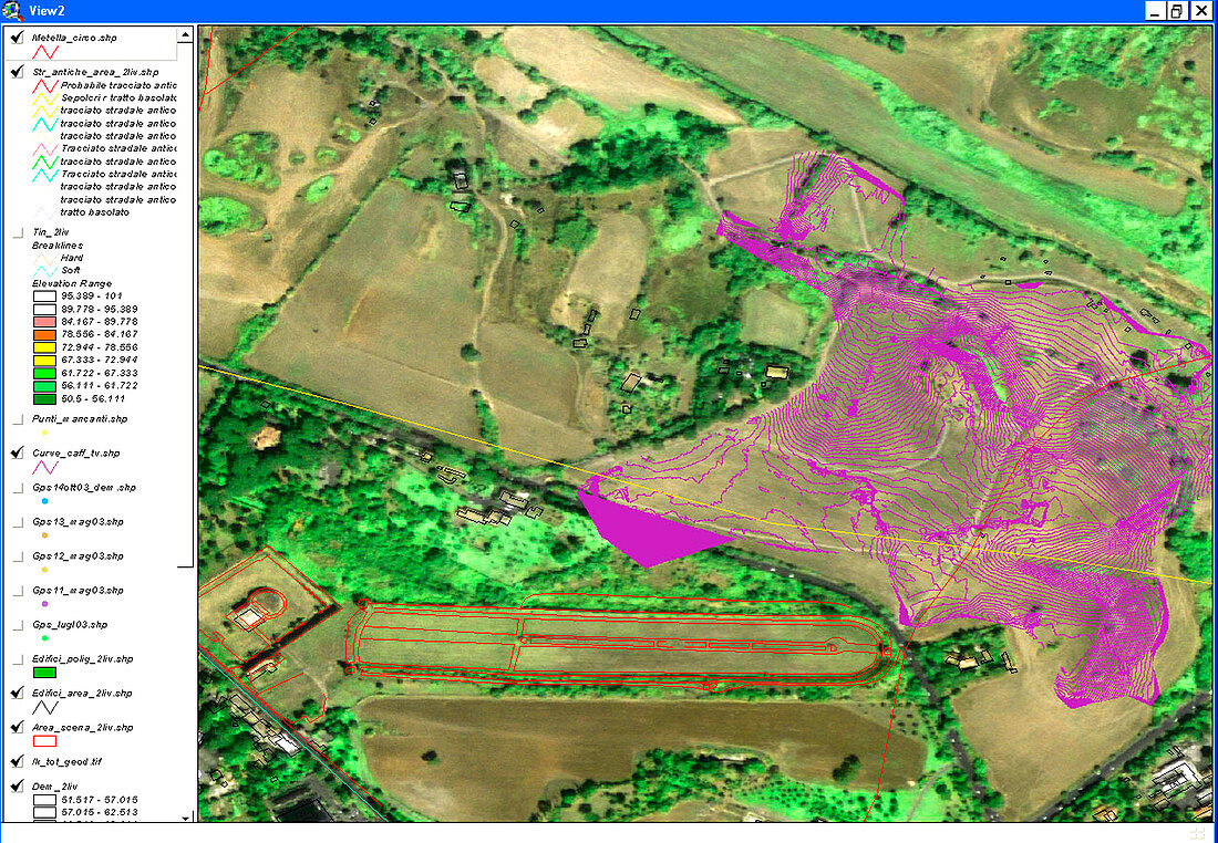
| Caffarella Park,Rome,geographical model. Screenshot of a geographical information system (GIS) display of the topography,landscape and archaeological features of Caffarella Park,Rome,Italy. The GIS display presents the results of the processing and co-ordination of a wide range of information. The purple lines show the contours of the valley,while the red lines show outlines of a racetrack,the Circus Maxentius. Other ruins found in this park include the Tomb of Cecilia Metella,the Nymphaeum of Egeria,and the Tomb of Annia Regilla. This mapping work was carried out by the Laboratory for the Virtual Heritage of Rome | |
| Lizenzart: | Lizenzpflichtig |
| Credit: | Science Photo Library / Sorrentino, Pasquale |
| Bildgröße: | 3567 px × 2472 px |
| Modell-Rechte: | nicht erforderlich |
| Eigentums-Rechte: | nicht erforderlich |
| Restrictions: |
|
Preise für dieses Bild ab 15 €
Universitäten & Organisationen
(Informationsmaterial Digital, Informationsmaterial Print, Lehrmaterial Digital etc.)
ab 15 €
Redaktionell
(Bücher, Bücher: Sach- und Fachliteratur, Digitale Medien (redaktionell) etc.)
ab 30 €
Werbung
(Anzeigen, Aussenwerbung, Digitale Medien, Fernsehwerbung, Karten, Werbemittel, Zeitschriften etc.)
ab 55 €
Handelsprodukte
(bedruckte Textilie, Kalender, Postkarte, Grußkarte, Verpackung etc.)
ab 75 €
Pauschalpreise
Rechtepakete für die unbeschränkte Bildnutzung in Print oder Online
ab 495 €