Nazca lines
Bildnummer 11750624
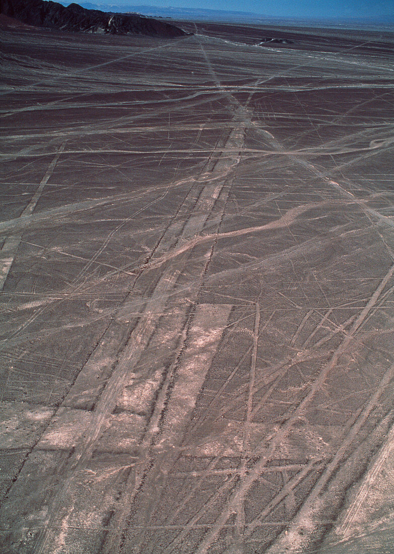
| Nazca lines. Aerial photograph of geoglyphs,or landscape drawings,in the coastal desert of southern Peru. These geoglyphs (long rectangular strips) may have been used for astronomical purposes to aid planning of seasonal agriculture. Other geoglyphs (not seen) take the form of stylised animals and other objects,possibly for ceremonial and religious purposes. They cover huge areas and can only be properly seen from the air. They were made by removing the dark surface stone to reveal a lighter stone layer underneath. They are thought to have been made by the Nazca,a native South American people,around 2000 years ago | |
| Lizenzart: | Lizenzpflichtig |
| Credit: | Science Photo Library / Nunuk, David |
| Bildgröße: | 3156 px × 4442 px |
| Modell-Rechte: | nicht erforderlich |
| Eigentums-Rechte: | nicht erforderlich |
| Restrictions: | - |
Preise für dieses Bild ab 15 €
Universitäten & Organisationen
(Informationsmaterial Digital, Informationsmaterial Print, Lehrmaterial Digital etc.)
ab 15 €
Redaktionell
(Bücher, Bücher: Sach- und Fachliteratur, Digitale Medien (redaktionell) etc.)
ab 30 €
Werbung
(Anzeigen, Aussenwerbung, Digitale Medien, Fernsehwerbung, Karten, Werbemittel, Zeitschriften etc.)
ab 55 €
Handelsprodukte
(bedruckte Textilie, Kalender, Postkarte, Grußkarte, Verpackung etc.)
ab 75 €
Pauschalpreise
Rechtepakete für die unbeschränkte Bildnutzung in Print oder Online
ab 495 €