Nazca lines
Bildnummer 11750616
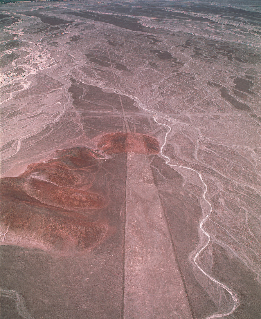
| Nazca lines. Aerial photograph of a geoglyph,or landscape drawing,in the coastal desert of southern Peru. This geoglyph consists of a wide strip running from bottom to centre with three lines radiating out from its end. Other geoglyphs (not seen) take the form of stylised animals and unknown objects. They cover huge areas and can only be properly seen from the air. They were made by removing the dark surface stone to reveal a lighter stone layer underneath. They are thought to have been made by the Nazca,a native South American people,around 2000 years ago. Theories about the lines have ranged from uses in astronomy (for seasonal agriculture) to uses in religion | |
| Lizenzart: | Lizenzpflichtig |
| Credit: | Science Photo Library / Nunuk, David |
| Bildgröße: | 3402 px × 4162 px |
| Modell-Rechte: | nicht erforderlich |
| Eigentums-Rechte: | nicht erforderlich |
| Restrictions: | - |
Preise für dieses Bild ab 15 €
Universitäten & Organisationen
(Informationsmaterial Digital, Informationsmaterial Print, Lehrmaterial Digital etc.)
ab 15 €
Redaktionell
(Bücher, Bücher: Sach- und Fachliteratur, Digitale Medien (redaktionell) etc.)
ab 30 €
Werbung
(Anzeigen, Aussenwerbung, Digitale Medien, Fernsehwerbung, Karten, Werbemittel, Zeitschriften etc.)
ab 55 €
Handelsprodukte
(bedruckte Textilie, Kalender, Postkarte, Grußkarte, Verpackung etc.)
ab 75 €
Pauschalpreise
Rechtepakete für die unbeschränkte Bildnutzung in Print oder Online
ab 495 €