LIDAR equipment measuring air pollutants
Bildnummer 11750306
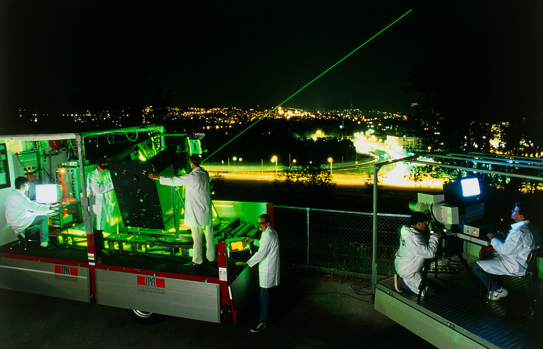
| Pollution monitoring. Researchers operating Light Detection and Ranging (LIDAR) equipment from the back of two trucks. LIDAR equipment measures the composition of clouds of pollutants in the atmosphere over a 100 kilometre range. It works because each type of molecule absorbs different and specific wavelengths of light. LIDAR fires a laser (green beam of light) of a specific wavelength into the sky. The equipment measures the intensity of the light reflected back. From this the absorption of light can be calculated and hence the level of the specific pollutant. LIDAR was developed at Lausanne Polytechnic (EPFL),Switzerland. Photographed in Lausanne | |
| Lizenzart: | Lizenzpflichtig |
| Credit: | Science Photo Library / Goetgheluck, Pascal |
| Bildgröße: | 3944 px × 2537 px |
| Modell-Rechte: | Derzeit liegt noch kein Release vor. Bitte kontaktieren Sie uns vor Verwendung. |
| Eigentums-Rechte: | nicht erforderlich |
| Restrictions: | - |
Preise für dieses Bild ab 15 €
Universitäten & Organisationen
(Informationsmaterial Digital, Informationsmaterial Print, Lehrmaterial Digital etc.)
ab 15 €
Redaktionell
(Bücher, Bücher: Sach- und Fachliteratur, Digitale Medien (redaktionell) etc.)
ab 30 €
Werbung
(Anzeigen, Aussenwerbung, Digitale Medien, Fernsehwerbung, Karten, Werbemittel, Zeitschriften etc.)
ab 55 €
Handelsprodukte
(bedruckte Textilie, Kalender, Postkarte, Grußkarte, Verpackung etc.)
ab 75 €
Pauschalpreise
Rechtepakete für die unbeschränkte Bildnutzung in Print oder Online
ab 495 €