The National Mall,Washington DC,USA
Bildnummer 11749037
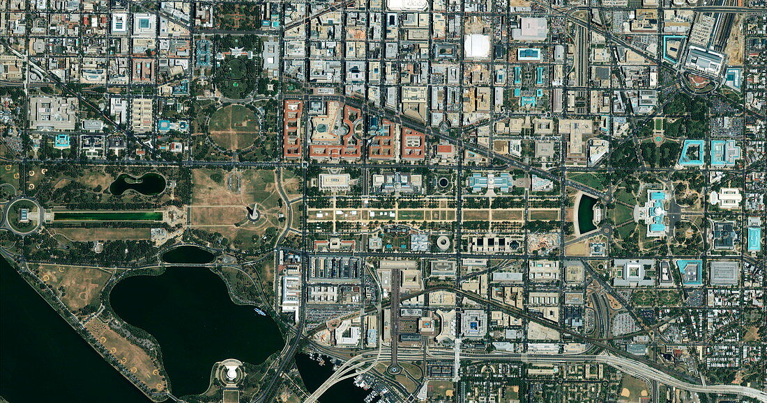
| The National Mall. Satellite image of the area around the National Mall,Washington DC,USA,the capital city of the USA. The area seen here is mostly government buildings,museums,monuments and other landmarks. The Potomac River is seen at bottom left. The strip across centre is the area known as the National Mall. It runs from the Abraham Lincoln Memorial (left) to the government buildings of the Capitol area (right). Just left of the centre of the Mall,surrounded by a brown patch,is the Washington Monument. The White House is above that,at upper left. The Thomas Jefferson Memorial (white) is on the lower left edge. Image taken by the Ikonos satellite on 3 June 2002 | |
| Lizenzart: | Lizenzpflichtig |
| Credit: | Science Photo Library / Geoeye |
| Bildgröße: | 5698 px × 2997 px |
| Modell-Rechte: | nicht erforderlich |
| Eigentums-Rechte: | nicht erforderlich |
| Restrictions: | - |
Preise für dieses Bild ab 15 €
Universitäten & Organisationen
(Informationsmaterial Digital, Informationsmaterial Print, Lehrmaterial Digital etc.)
ab 15 €
Redaktionell
(Bücher, Bücher: Sach- und Fachliteratur, Digitale Medien (redaktionell) etc.)
ab 30 €
Werbung
(Anzeigen, Aussenwerbung, Digitale Medien, Fernsehwerbung, Karten, Werbemittel, Zeitschriften etc.)
ab 55 €
Handelsprodukte
(bedruckte Textilie, Kalender, Postkarte, Grußkarte, Verpackung etc.)
ab 75 €
Pauschalpreise
Rechtepakete für die unbeschränkte Bildnutzung in Print oder Online
ab 495 €
Keywords
- 21. Jahrhundert,
- Amerikanisch,
- Dorf,
- Erdbeobachtung,
- geografisch,
- Geographie,
- IKONOS,
- Monument,
- Nordamerika,
- Regierung,
- Satellit,
- Satellitenbild,
- Sehenswürdigkeiten,
- Stadt,
- städtisch,
- Tourismus,
- Touristenattraktion,
- uns,
- USA,
- Vereinigte Staaten,
- Wahrzeichen,
- Washington Monument,
- Weißes Haus,
- Weltall