Newark city centre,USA
Bildnummer 11748921
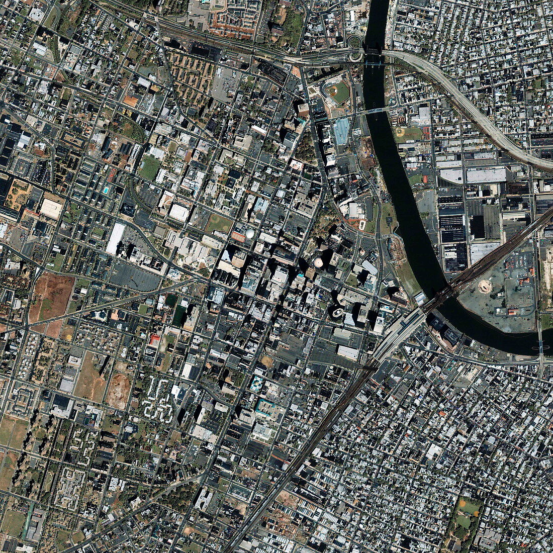
| Newark. Satellite image of the city centre of Newark,New Jersey,USA. North is at top. A branch of the Passaic River is at top right. Skyscrapers are seen in the city centre (centre). The major transport links include a railway (across lower right) and Interstate 280 (motorway,across top). Areas of housing are at top and bottom right. The large area of parks,buildings and car parks seen at upper centre is Essex County College. The area shown here is around 4 kilometres across. Image taken by the Ikonos satellite on 15 September 2001 | |
| Lizenzart: | Lizenzpflichtig |
| Credit: | Science Photo Library / Geoeye |
| Bildgröße: | 3000 px × 3000 px |
| Modell-Rechte: | nicht erforderlich |
| Eigentums-Rechte: | nicht erforderlich |
| Restrictions: | - |
Preise für dieses Bild ab 15 €
Universitäten & Organisationen
(Informationsmaterial Digital, Informationsmaterial Print, Lehrmaterial Digital etc.)
ab 15 €
Redaktionell
(Bücher, Bücher: Sach- und Fachliteratur, Digitale Medien (redaktionell) etc.)
ab 30 €
Werbung
(Anzeigen, Aussenwerbung, Digitale Medien, Fernsehwerbung, Karten, Werbemittel, Zeitschriften etc.)
ab 55 €
Handelsprodukte
(bedruckte Textilie, Kalender, Postkarte, Grußkarte, Verpackung etc.)
ab 75 €
Pauschalpreise
Rechtepakete für die unbeschränkte Bildnutzung in Print oder Online
ab 495 €