New York City,USA
Bildnummer 11748919
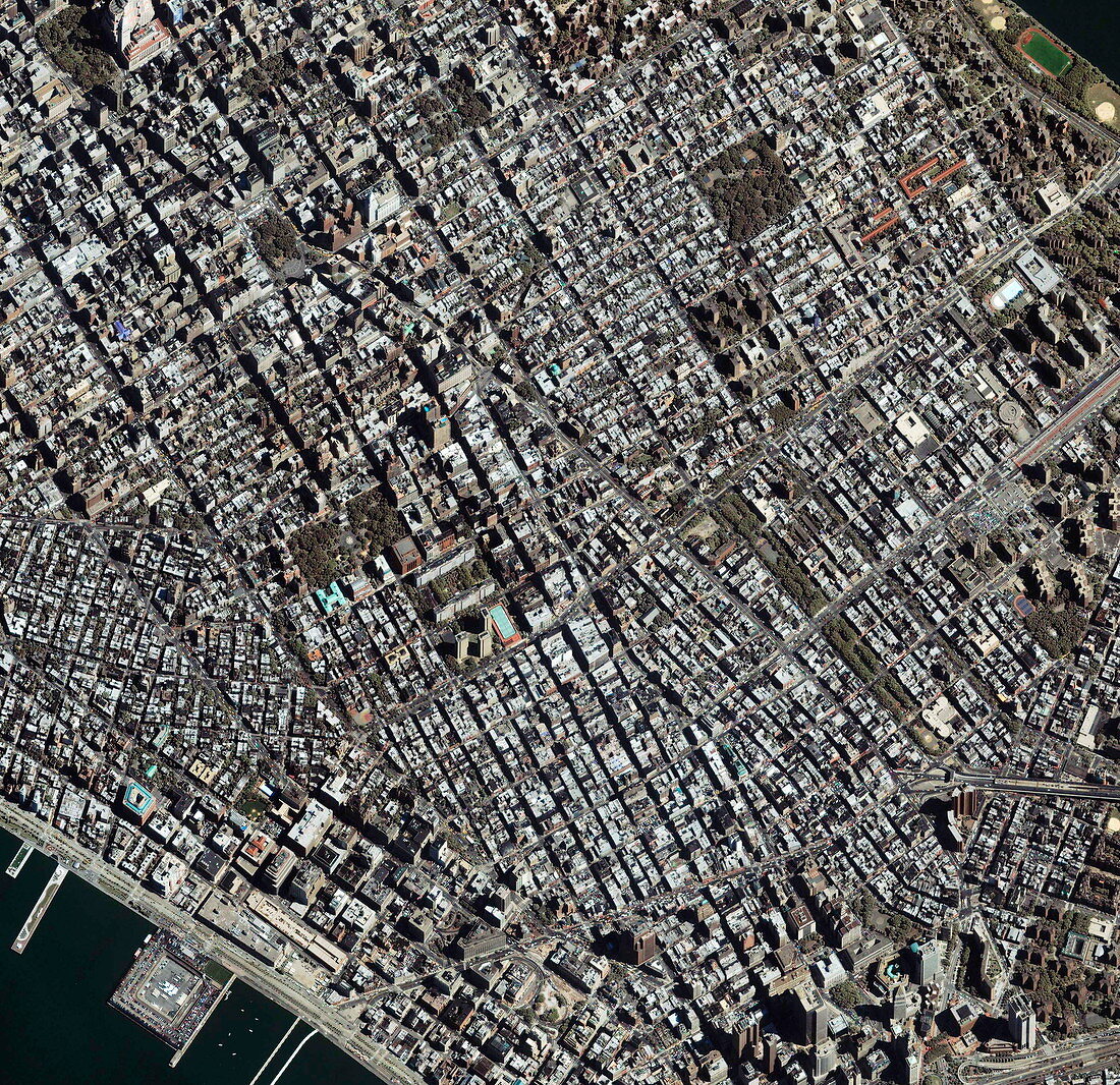
| New York. Satellite image of the Greenwich Village area (centre) and its surroundings,in Manhattan,New York City,USA. North is at upper left. This view covers the entire width of Manhattan Island at this point,from the piers of the Hudson River (bottom left) to the East River Park (top right),a distance of about 3.5 kilometres. At upper right is Tompkins Square Park (green),with Washington Square Park (rectangular,green) at centre left. Skyscrapers are seen at bottom right. Broadway runs diagonally across the image towards top left,where a large building dominates Madison Square Park. Image taken by the Ikonos satellite on 10 September 2003 | |
| Lizenzart: | Lizenzpflichtig |
| Credit: | Science Photo Library / Geoeye |
| Bildgröße: | 3000 px × 2908 px |
| Modell-Rechte: | nicht erforderlich |
| Eigentums-Rechte: | nicht erforderlich |
| Restrictions: | - |
Preise für dieses Bild ab 15 €
Universitäten & Organisationen
(Informationsmaterial Digital, Informationsmaterial Print, Lehrmaterial Digital etc.)
ab 15 €
Redaktionell
(Bücher, Bücher: Sach- und Fachliteratur, Digitale Medien (redaktionell) etc.)
ab 30 €
Werbung
(Anzeigen, Aussenwerbung, Digitale Medien, Fernsehwerbung, Karten, Werbemittel, Zeitschriften etc.)
ab 55 €
Handelsprodukte
(bedruckte Textilie, Kalender, Postkarte, Grußkarte, Verpackung etc.)
ab 75 €
Pauschalpreise
Rechtepakete für die unbeschränkte Bildnutzung in Print oder Online
ab 495 €