Munich city centre,Germany
Bildnummer 11748915
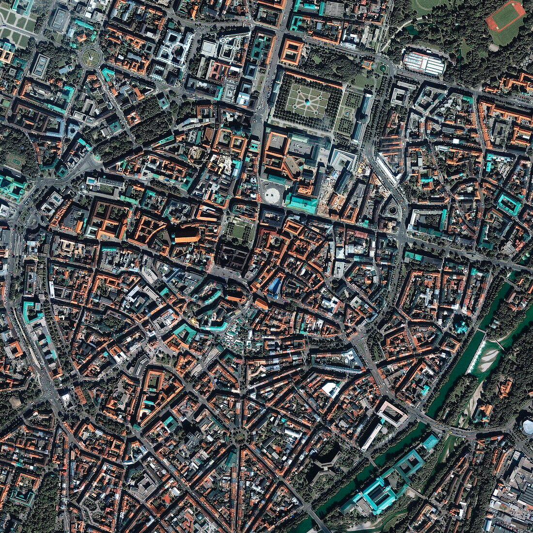
| Munich. Satellite image of the historical city centre (the Altstadt) of Munich,Bavaria,Germany. North is at top. The area shown here is about 3 kilometres across. A ring-shaped road runs around the Altstadt,and numerous buildings,squares and marketplaces are seen in this area. The River Isar is seen at lower right. Image taken by the Ikonos satellite on 3 September 2001 | |
| Lizenzart: | Lizenzpflichtig |
| Credit: | Science Photo Library / Geoeye |
| Bildgröße: | 2925 px × 2925 px |
| Modell-Rechte: | nicht erforderlich |
| Eigentums-Rechte: | nicht erforderlich |
| Restrictions: | - |
Preise für dieses Bild ab 15 €
Universitäten & Organisationen
(Informationsmaterial Digital, Informationsmaterial Print, Lehrmaterial Digital etc.)
ab 15 €
Redaktionell
(Bücher, Bücher: Sach- und Fachliteratur, Digitale Medien (redaktionell) etc.)
ab 30 €
Werbung
(Anzeigen, Aussenwerbung, Digitale Medien, Fernsehwerbung, Karten, Werbemittel, Zeitschriften etc.)
ab 55 €
Handelsprodukte
(bedruckte Textilie, Kalender, Postkarte, Grußkarte, Verpackung etc.)
ab 75 €
Pauschalpreise
Rechtepakete für die unbeschränkte Bildnutzung in Print oder Online
ab 495 €