Istanbul,Turkey
Bildnummer 11748901
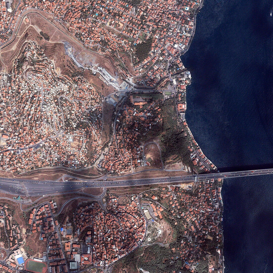
| Istanbul,Turkey. Satellite image of a small area of the city of Istanbul,Turkey. North is at top. This area is on the western (European) shore of the Bosphorus (right),the narrow strait of water separating Europe from Asia. Numerous buildings (red) are seen,and a motorway (across bottom). At lower right,a suspension bridge (the Fatih Sultan Mehmet Bridge,or the Second Bosphorus Bridge,completed 1988) carries the motorway across the Bosphorus. Four lanes of traffic travel each way on the motorway (part of the Trans-European Motorway),with a toll booth at lower left. Cloud shadows are also seen on part of the image. Image taken by the Ikonos satellite on 11 May 2000 | |
| Lizenzart: | Lizenzpflichtig |
| Credit: | Science Photo Library / Geoeye |
| Bildgröße: | 3000 px × 3000 px |
| Modell-Rechte: | nicht erforderlich |
| Eigentums-Rechte: | nicht erforderlich |
| Restrictions: | - |
Preise für dieses Bild ab 15 €
Universitäten & Organisationen
(Informationsmaterial Digital, Informationsmaterial Print, Lehrmaterial Digital etc.)
ab 15 €
Redaktionell
(Bücher, Bücher: Sach- und Fachliteratur, Digitale Medien (redaktionell) etc.)
ab 30 €
Werbung
(Anzeigen, Aussenwerbung, Digitale Medien, Fernsehwerbung, Karten, Werbemittel, Zeitschriften etc.)
ab 55 €
Handelsprodukte
(bedruckte Textilie, Kalender, Postkarte, Grußkarte, Verpackung etc.)
ab 75 €
Pauschalpreise
Rechtepakete für die unbeschränkte Bildnutzung in Print oder Online
ab 495 €