London,satellite image
Bildnummer 11748786
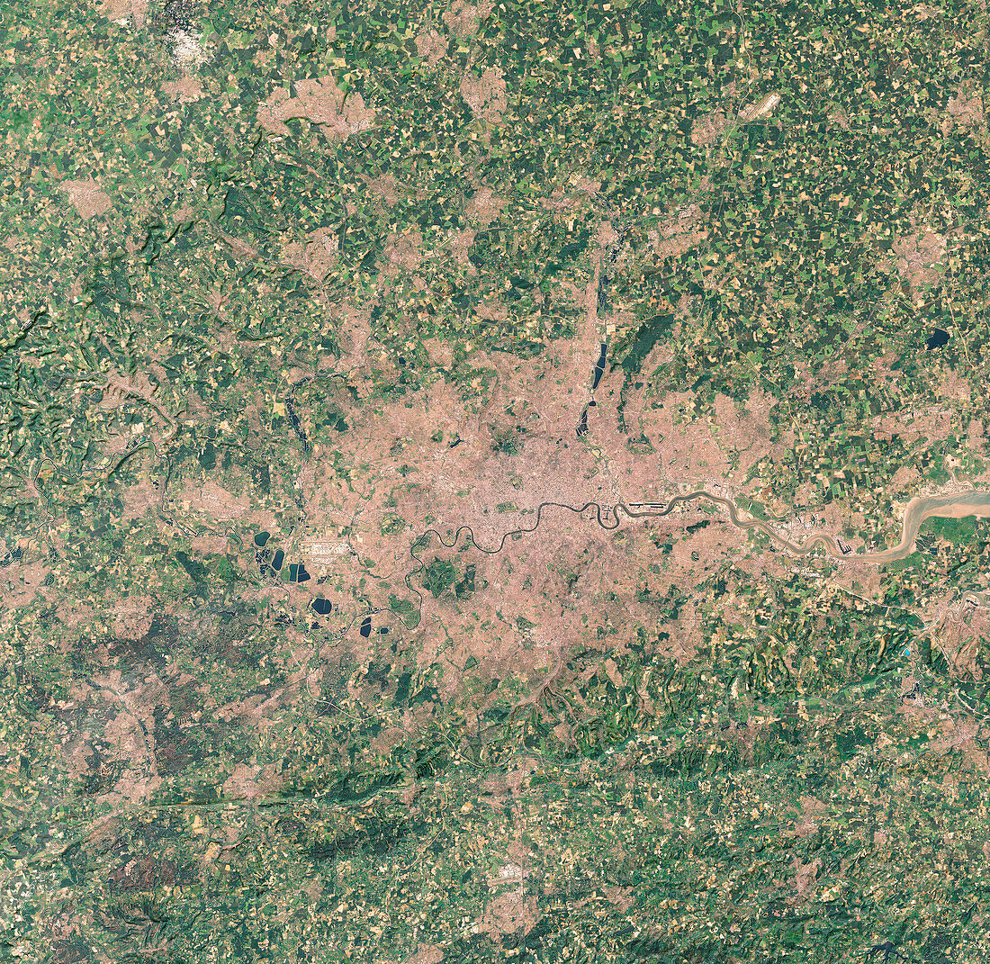
| London. True-colour satellite image of London,capital of England and Britain,and its surrounding counties. North is at top. The River Thames runs eastwards across the centre of the image. Built-up areas are brown and vegetation is green. The pale area to the west of London at centre left is Heathrow Airport. Several large lakes (dark green) are seen to the south and west of the airport. At lower centre,also appearing pale,is London's second major airport,Gatwick,in the county of West Sussex. The town of Maidenhead is just to the west of a vertical portion of the Thames,slightly further west of London than Heathrow | |
| Lizenzart: | Lizenzpflichtig |
| Credit: | Science Photo Library / Infoterra |
| Bildgröße: | 7072 px × 6888 px |
| Modell-Rechte: | nicht erforderlich |
| Eigentums-Rechte: | nicht erforderlich |
| Restrictions: | - |
Preise für dieses Bild ab 15 €
Universitäten & Organisationen
(Informationsmaterial Digital, Informationsmaterial Print, Lehrmaterial Digital etc.)
ab 15 €
Redaktionell
(Bücher, Bücher: Sach- und Fachliteratur, Digitale Medien (redaktionell) etc.)
ab 30 €
Werbung
(Anzeigen, Aussenwerbung, Digitale Medien, Fernsehwerbung, Karten, Werbemittel, Zeitschriften etc.)
ab 55 €
Handelsprodukte
(bedruckte Textilie, Kalender, Postkarte, Grußkarte, Verpackung etc.)
ab 75 €
Pauschalpreise
Rechtepakete für die unbeschränkte Bildnutzung in Print oder Online
ab 495 €