Karachi,satellite photograph,1992
Bildnummer 11748783
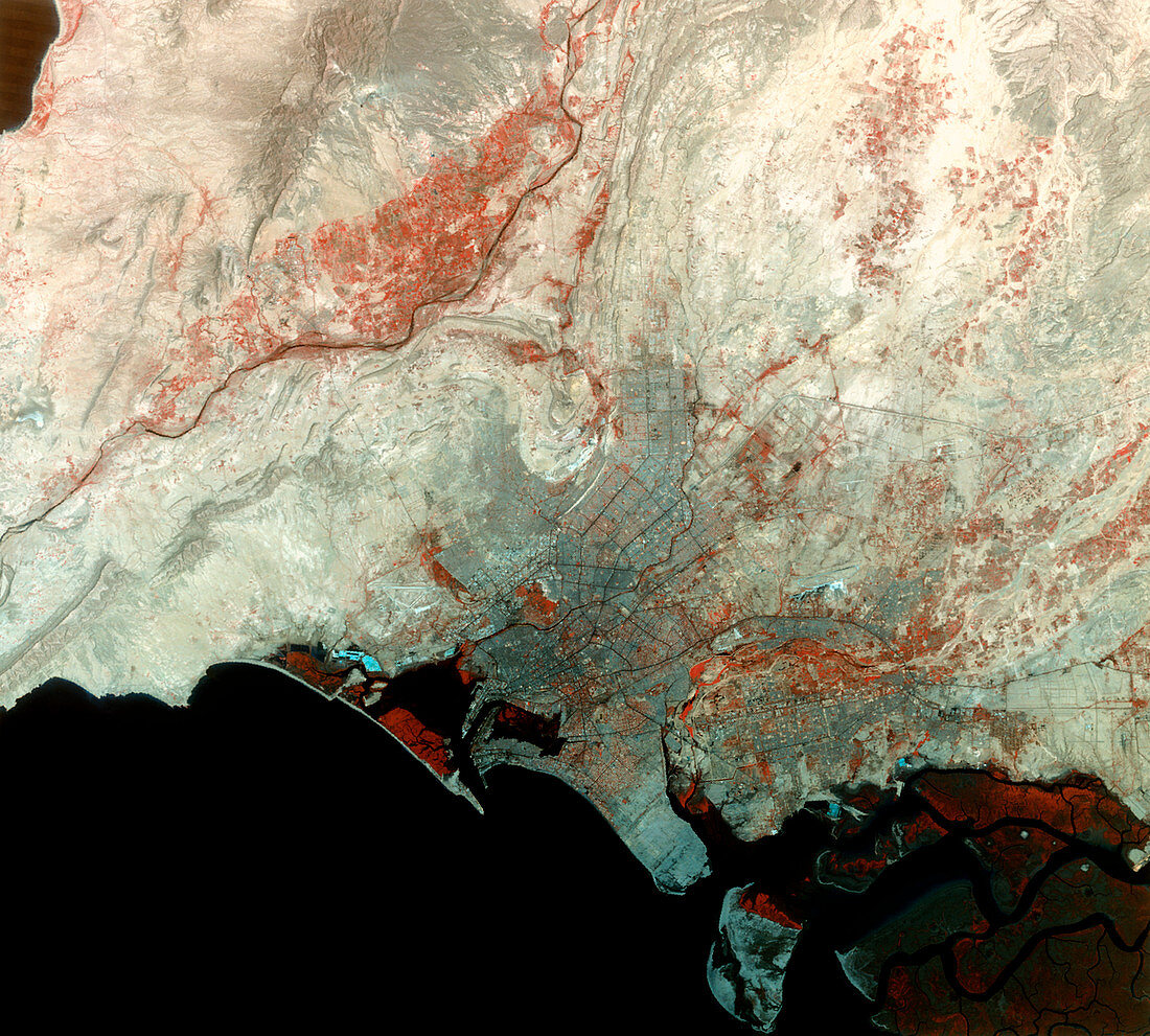
| Karachi,Pakistan,satellite image. North is at top. Water is black,barren land is white,urban areas are grey and vegetation is red. The city of Karachi (lower centre) is on Pakistan's coast with the Arabian Sea (part of the Indian Ocean). Part of the delta of the Indus River is at bottom right and the Hab River flows across upper left. The sea wall of the harbour is seen at left of Manora Head promontory which itself lies at left of one of the islands formed in the delta. This 65-kilometre- wide,visible and infrared image was taken on 27 April 1992 by the Thematic Mapper (TM) sensor on a NASA Landsat satellite | |
| Lizenzart: | Lizenzpflichtig |
| Credit: | Science Photo Library / MDA Information Systems |
| Bildgröße: | 4488 px × 4044 px |
| Modell-Rechte: | nicht erforderlich |
| Eigentums-Rechte: | nicht erforderlich |
| Restrictions: | - |
Preise für dieses Bild ab 15 €
Universitäten & Organisationen
(Informationsmaterial Digital, Informationsmaterial Print, Lehrmaterial Digital etc.)
ab 15 €
Redaktionell
(Bücher, Bücher: Sach- und Fachliteratur, Digitale Medien (redaktionell) etc.)
ab 30 €
Werbung
(Anzeigen, Aussenwerbung, Digitale Medien, Fernsehwerbung, Karten, Werbemittel, Zeitschriften etc.)
ab 55 €
Handelsprodukte
(bedruckte Textilie, Kalender, Postkarte, Grußkarte, Verpackung etc.)
ab 75 €
Pauschalpreise
Rechtepakete für die unbeschränkte Bildnutzung in Print oder Online
ab 495 €