Los Angeles,radar image
Bildnummer 11748774
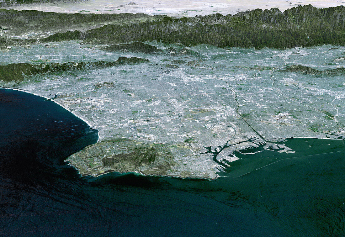
| Los Angeles. Coloured three-dimensional computer map of Los Angeles,California,USA. The land topography was mapped by the Shuttle Radar Topography Mission (SRTM) on the Space Shuttle Endeavour,using reflected radar pulses. Colours are from a Landsat 7 image. At lower left is the Palos Verdes Peninsula; to its right is Long Beach Harbour. At top are the San Gabriel Mountains (brown) and the Mojave Desert (white). The height of features is exaggerated 1.5 times in this image. SRTM was a joint mission of NASA,the USA's National Imagery and Mapping Agency (NIMA),and the German and Italian space agencies | |
| Lizenzart: | Lizenzpflichtig |
| Credit: | Science Photo Library / NASA |
| Bildgröße: | 3000 px × 2063 px |
| Modell-Rechte: | nicht erforderlich |
| Eigentums-Rechte: | nicht erforderlich |
| Restrictions: | - |
Preise für dieses Bild ab 15 €
Universitäten & Organisationen
(Informationsmaterial Digital, Informationsmaterial Print, Lehrmaterial Digital etc.)
ab 15 €
Redaktionell
(Bücher, Bücher: Sach- und Fachliteratur, Digitale Medien (redaktionell) etc.)
ab 30 €
Werbung
(Anzeigen, Aussenwerbung, Digitale Medien, Fernsehwerbung, Karten, Werbemittel, Zeitschriften etc.)
ab 55 €
Handelsprodukte
(bedruckte Textilie, Kalender, Postkarte, Grußkarte, Verpackung etc.)
ab 75 €
Pauschalpreise
Rechtepakete für die unbeschränkte Bildnutzung in Print oder Online
ab 495 €
Keywords
- 3-d,
- 3D,
- Amerika,
- Amerikanisch,
- Deutsche,
- Dreidimensional,
- farbig,
- geografisch,
- Geographie,
- Hafen,
- Italienisch,
- Karte,
- Land,
- Linderung,
- Los Angeles,
- Mission,
- Mosaik-,
- NASA,
- Satellitenbild,
- SRTM,
- Stadt,
- Städte,
- städtisch,
- Terrain,
- topografisch,
- Topographie,
- uns,
- Urbanisierung,
- USA,
- Vereinigte Staaten,
- Weltall,
- Zusammengesetzt