New York City
Bildnummer 11748745
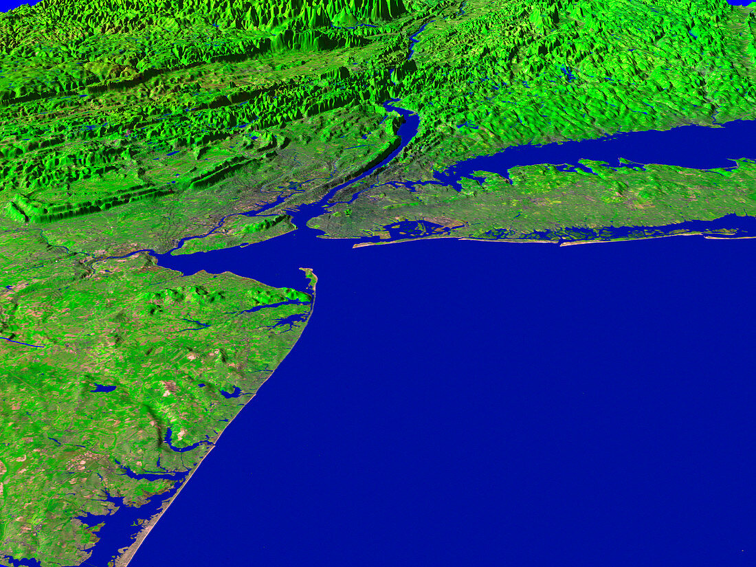
| New York City. Coloured three-dimensional computer image,based on satellite data,of New York City (upper centre),USA. North is towards the top. Vegetation is green and water is blue. The Hudson River (upper centre) flows south into the Atlantic Ocean (lower right). Long Island (upper right) and part of the New Jersey coastline (lower left) are also seen. The image was produced using Thematic Mapper data from an American Landsat satellite and terrain information from USGS (United States Geological Survey) digital elevation maps | |
| Lizenzart: | Lizenzpflichtig |
| Credit: | Science Photo Library / NASA's Goddard Space Flight Center |
| Bildgröße: | 2560 px × 1920 px |
| Modell-Rechte: | nicht erforderlich |
| Eigentums-Rechte: | nicht erforderlich |
| Restrictions: | - |
Preise für dieses Bild ab 15 €
Universitäten & Organisationen
(Informationsmaterial Digital, Informationsmaterial Print, Lehrmaterial Digital etc.)
ab 15 €
Redaktionell
(Bücher, Bücher: Sach- und Fachliteratur, Digitale Medien (redaktionell) etc.)
ab 30 €
Werbung
(Anzeigen, Aussenwerbung, Digitale Medien, Fernsehwerbung, Karten, Werbemittel, Zeitschriften etc.)
ab 55 €
Handelsprodukte
(bedruckte Textilie, Kalender, Postkarte, Grußkarte, Verpackung etc.)
ab 75 €
Pauschalpreise
Rechtepakete für die unbeschränkte Bildnutzung in Print oder Online
ab 495 €