Satellite image of Paris
Bildnummer 11748721
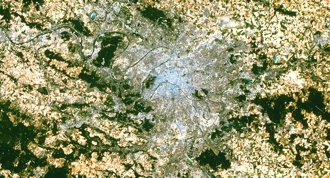
| Paris. True-colour satellite image of Paris,capital & largest city of France. North is at top. Urban areas appear in shades of grey. Forests are dark green,grazing areas are light green,& crops are mostly yellow. Bare ground appears pale yellow or brown,almost white. Rivers such as the Seine (flowing from bottom centre to top left) and Marne (from top right to the Seine) appear black. Paris is surrounded by a patchwork of agricultural fields. The Paris-Orly (lower centre) and Charles de Gaulle (upper right) airports are also seen. Image taken by the American Landsat-5 satellite. The smallest visible objects are 30 metres across | |
| Lizenzart: | Lizenzpflichtig |
| Credit: | Science Photo Library / Planetobserver |
| Bildgröße: | 5013 px × 2709 px |
| Modell-Rechte: | nicht erforderlich |
| Eigentums-Rechte: | nicht erforderlich |
| Restrictions: | - |
Preise für dieses Bild ab 15 €
Universitäten & Organisationen
(Informationsmaterial Digital, Informationsmaterial Print, Lehrmaterial Digital etc.)
ab 15 €
Redaktionell
(Bücher, Bücher: Sach- und Fachliteratur, Digitale Medien (redaktionell) etc.)
ab 30 €
Werbung
(Anzeigen, Aussenwerbung, Digitale Medien, Fernsehwerbung, Karten, Werbemittel, Zeitschriften etc.)
ab 55 €
Handelsprodukte
(bedruckte Textilie, Kalender, Postkarte, Grußkarte, Verpackung etc.)
ab 75 €
Pauschalpreise
Rechtepakete für die unbeschränkte Bildnutzung in Print oder Online
ab 495 €