Berlin from space
Bildnummer 11748711
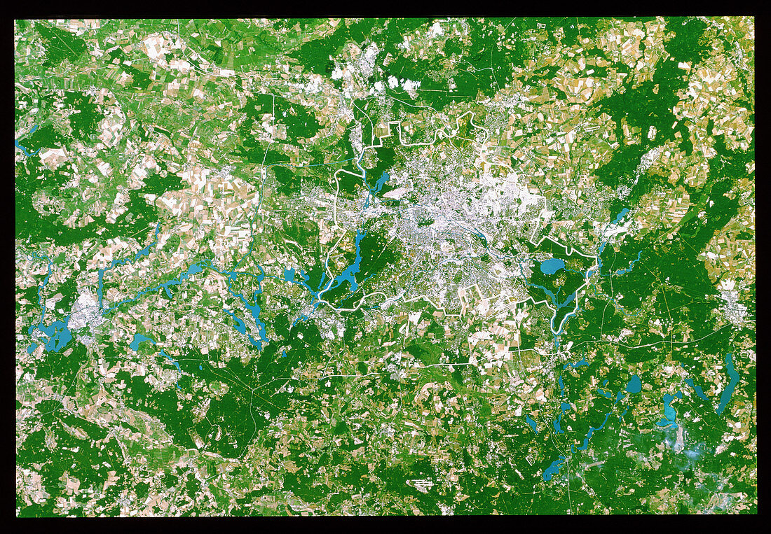
| Berlin. True-colour satellite image of Berlin (upper right),capital of Germany and one of that country's 16 states (Lander); the city limits are outlined in white. North is at top. Urban areas such as Berlin and Brandenburg (left) appear grey. Forests are dark green,grazing lands are light green and crops are mostly yellow. Bare ground appears pale yellow or brown,almost white. The countryside around Berlin features a number of lakes (blue). Image taken by the American Landsat-5 satellite. The smallest visible features are 30 metres across | |
| Lizenzart: | Lizenzpflichtig |
| Credit: | Science Photo Library / Planetobserver |
| Bildgröße: | 4724 px × 3277 px |
| Modell-Rechte: | nicht erforderlich |
| Eigentums-Rechte: | nicht erforderlich |
| Restrictions: | - |
Preise für dieses Bild ab 15 €
Universitäten & Organisationen
(Informationsmaterial Digital, Informationsmaterial Print, Lehrmaterial Digital etc.)
ab 15 €
Redaktionell
(Bücher, Bücher: Sach- und Fachliteratur, Digitale Medien (redaktionell) etc.)
ab 30 €
Werbung
(Anzeigen, Aussenwerbung, Digitale Medien, Fernsehwerbung, Karten, Werbemittel, Zeitschriften etc.)
ab 55 €
Handelsprodukte
(bedruckte Textilie, Kalender, Postkarte, Grußkarte, Verpackung etc.)
ab 75 €
Pauschalpreise
Rechtepakete für die unbeschränkte Bildnutzung in Print oder Online
ab 495 €