Landsat infrared image of New York City
Bildnummer 11748694
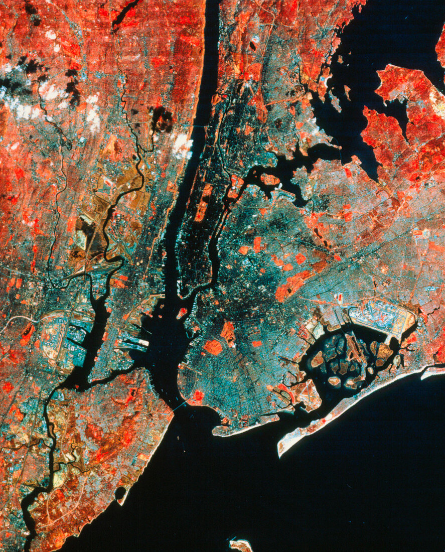
| Landsat infrared image of the city of New York & surrounding districts. The island at bottom left is Staten Island with Arthur Kill,the strip of water separating the island from the mainland,leading into Newark Bay (left). The river running to the top of the image is the Hudson River,with Manhattan to its right. Central Park is visible as a red rectangle. Long Island (right) is connected to Staten Island by the Narrows Bridge. The spit of land at bottom right is Rockaway Park,which partially encloses a cluster of islands in what is known as Jamaica Bay. Kennedy Airport is the light coloured rectangular complex at right | |
| Lizenzart: | Lizenzpflichtig |
| Credit: | Science Photo Library / MDA Information Systems |
| Bildgröße: | 2582 px × 3203 px |
| Modell-Rechte: | nicht erforderlich |
| Eigentums-Rechte: | nicht erforderlich |
| Restrictions: | - |
Preise für dieses Bild ab 15 €
Universitäten & Organisationen
(Informationsmaterial Digital, Informationsmaterial Print, Lehrmaterial Digital etc.)
ab 15 €
Redaktionell
(Bücher, Bücher: Sach- und Fachliteratur, Digitale Medien (redaktionell) etc.)
ab 30 €
Werbung
(Anzeigen, Aussenwerbung, Digitale Medien, Fernsehwerbung, Karten, Werbemittel, Zeitschriften etc.)
ab 55 €
Handelsprodukte
(bedruckte Textilie, Kalender, Postkarte, Grußkarte, Verpackung etc.)
ab 75 €
Pauschalpreise
Rechtepakete für die unbeschränkte Bildnutzung in Print oder Online
ab 495 €