Coloured radar satellite image of Helsinki
Bildnummer 11748688
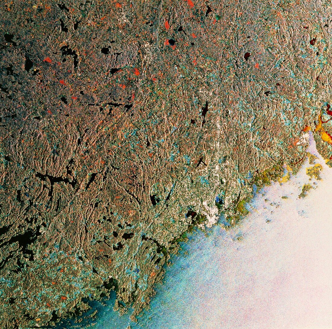
| Helsinki. Coloured radar satellite image of Helsinki (white,on coast),capital of Finland. North is towards the top. This image is a combination of three frames taken on different dates. Differences between frames show as areas of colour. Cultivated land (lower left,for example) appears red,blue or green,the different colours indicating growth of different crops between frames. Colours on the sea are due to differences in wave patterns. Most of the land is covered with conifer forest (brown-green). Helsinki lies on a peninsula surrounded by islands on the coast of the Gulf of Finland. Image produced by European Radar Satellite 1. Area approx. 100km x 100km | |
| Lizenzart: | Lizenzpflichtig |
| Credit: | Science Photo Library / ESA, EURIMAGE |
| Bildgröße: | 4233 px × 4201 px |
| Modell-Rechte: | nicht erforderlich |
| Eigentums-Rechte: | nicht erforderlich |
| Restrictions: |
|
Preise für dieses Bild ab 15 €
Universitäten & Organisationen
(Informationsmaterial Digital, Informationsmaterial Print, Lehrmaterial Digital etc.)
ab 15 €
Redaktionell
(Bücher, Bücher: Sach- und Fachliteratur, Digitale Medien (redaktionell) etc.)
ab 30 €
Werbung
(Anzeigen, Aussenwerbung, Digitale Medien, Fernsehwerbung, Karten, Werbemittel, Zeitschriften etc.)
ab 55 €
Handelsprodukte
(bedruckte Textilie, Kalender, Postkarte, Grußkarte, Verpackung etc.)
ab 75 €
Pauschalpreise
Rechtepakete für die unbeschränkte Bildnutzung in Print oder Online
ab 495 €