ERS-1 radar satellite image of Reggio di Calabria
Bildnummer 11748683
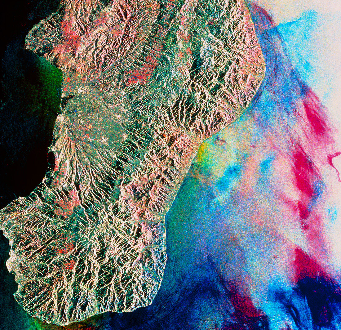
| Reggio di Calabria. Coloured radar satellite image of the Italian port Reggio di Calabria (white area on coast,lower left). This image shows the "toe" at the southern tip of mainland Italy. North is towards the top. The image was made by combining three frames taken on different dates. Differences between the frames show as areas of colour. Farmland is red,green or yellow,the different colours indicating growth of different types of vegetation between frames. Colours on the sea are due to differences in wave patterns. The rippled pattern inland is caused by reflection of radar off mountain slopes. Image produced by European Radar Satellite 1. Area approx. 100km x 100km | |
| Lizenzart: | Lizenzpflichtig |
| Credit: | Science Photo Library / ESA, EURIMAGE |
| Bildgröße: | 4298 px × 4157 px |
| Modell-Rechte: | nicht erforderlich |
| Eigentums-Rechte: | nicht erforderlich |
| Restrictions: |
|
Preise für dieses Bild ab 15 €
Universitäten & Organisationen
(Informationsmaterial Digital, Informationsmaterial Print, Lehrmaterial Digital etc.)
ab 15 €
Redaktionell
(Bücher, Bücher: Sach- und Fachliteratur, Digitale Medien (redaktionell) etc.)
ab 30 €
Werbung
(Anzeigen, Aussenwerbung, Digitale Medien, Fernsehwerbung, Karten, Werbemittel, Zeitschriften etc.)
ab 55 €
Handelsprodukte
(bedruckte Textilie, Kalender, Postkarte, Grußkarte, Verpackung etc.)
ab 75 €
Pauschalpreise
Rechtepakete für die unbeschränkte Bildnutzung in Print oder Online
ab 495 €