Space radar view of New York City,USA
Bildnummer 11748676
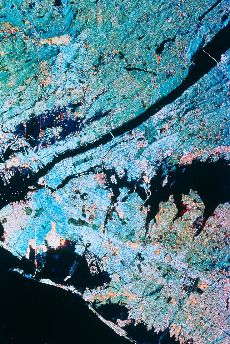
| New York city. Coloured radar image showing New York and its surroundings. Dense urban development shows as pale blue,notably on Manhattan Island (left of centre) and the western end of Long Island (lower left of centre). The green rectangle in Manhattan is Central Park,the colour representing moderate vegetation. Black areas are water. The Hudson River cuts across the frame from upper right,whilst at centre right is Long Island Sound. At the bottom of the frame is the Atlantic Ocean. The data for this image were gathered by the Spaceborne Imaging Radar-C (SIR-C) carried during Shuttle Mission STS-68 on 10 October 1994 | |
| Lizenzart: | Lizenzpflichtig |
| Credit: | Science Photo Library / NASA |
| Bildgröße: | 3478 px × 5197 px |
| Modell-Rechte: | nicht erforderlich |
| Eigentums-Rechte: | nicht erforderlich |
| Restrictions: | - |
Preise für dieses Bild ab 15 €
Universitäten & Organisationen
(Informationsmaterial Digital, Informationsmaterial Print, Lehrmaterial Digital etc.)
ab 15 €
Redaktionell
(Bücher, Bücher: Sach- und Fachliteratur, Digitale Medien (redaktionell) etc.)
ab 30 €
Werbung
(Anzeigen, Aussenwerbung, Digitale Medien, Fernsehwerbung, Karten, Werbemittel, Zeitschriften etc.)
ab 55 €
Handelsprodukte
(bedruckte Textilie, Kalender, Postkarte, Grußkarte, Verpackung etc.)
ab 75 €
Pauschalpreise
Rechtepakete für die unbeschränkte Bildnutzung in Print oder Online
ab 495 €