Landsat view of Budapest and surroundings
Bildnummer 11748666
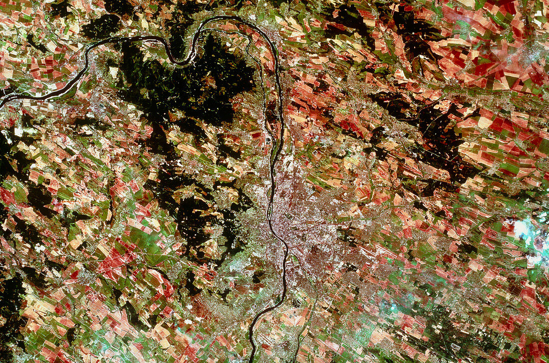
| Budapest,seen from space. Satellite view of Budapest,capital city of Hungary,and its surroundings. The city is the grey/brown patch at centre,and sits on the banks of the River Danube (black line). The surrounding terrain is fairly level,and supports large-scale agriculture. The city came into being with the amalgamation of two nearby settlements; Buda on the west bank of the river and Pest on the east bank. The data for this image were gathered by a Landsat satellite | |
| Lizenzart: | Lizenzpflichtig |
| Credit: | Science Photo Library / Geospace |
| Bildgröße: | 5184 px × 3431 px |
| Modell-Rechte: | nicht erforderlich |
| Eigentums-Rechte: | nicht erforderlich |
| Restrictions: | - |
Preise für dieses Bild ab 15 €
Universitäten & Organisationen
(Informationsmaterial Digital, Informationsmaterial Print, Lehrmaterial Digital etc.)
ab 15 €
Redaktionell
(Bücher, Bücher: Sach- und Fachliteratur, Digitale Medien (redaktionell) etc.)
ab 30 €
Werbung
(Anzeigen, Aussenwerbung, Digitale Medien, Fernsehwerbung, Karten, Werbemittel, Zeitschriften etc.)
ab 55 €
Handelsprodukte
(bedruckte Textilie, Kalender, Postkarte, Grußkarte, Verpackung etc.)
ab 75 €
Pauschalpreise
Rechtepakete für die unbeschränkte Bildnutzung in Print oder Online
ab 495 €