Landsat image of San Francisco Bay area
Bildnummer 11748640
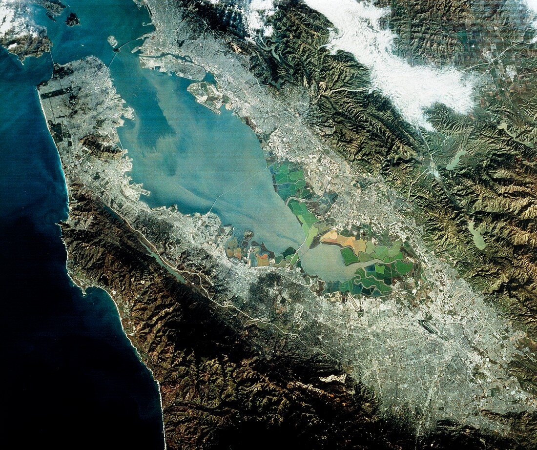
| Landsat image of the San Francisco Bay area,California,showing the cities of San Francisco (occupying the peninsula at upper left),San Jose (bottom right) & Oakland (top,opposite San Fran- cisco). Four bridges are visible; the Golden Gate Bridge (bridging the entrance to the bay at upper left),the Bay Bridge (top right),the San Mateo Bridge (centre) & the Dumbarton Bridge (bottom). Surrounding the bottom end of the bay is a green patchwork of salt beds. The colours are due to different populations of algae,indicating varying salinities. The two lakes to the south of San Francisco mark the path of the San Andreas Fault | |
| Lizenzart: | Lizenzpflichtig |
| Credit: | Science Photo Library / MDA Information Systems |
| Bildgröße: | 4622 px × 3874 px |
| Modell-Rechte: | nicht erforderlich |
| Eigentums-Rechte: | nicht erforderlich |
| Restrictions: | - |
Preise für dieses Bild ab 15 €
Universitäten & Organisationen
(Informationsmaterial Digital, Informationsmaterial Print, Lehrmaterial Digital etc.)
ab 15 €
Redaktionell
(Bücher, Bücher: Sach- und Fachliteratur, Digitale Medien (redaktionell) etc.)
ab 30 €
Werbung
(Anzeigen, Aussenwerbung, Digitale Medien, Fernsehwerbung, Karten, Werbemittel, Zeitschriften etc.)
ab 55 €
Handelsprodukte
(bedruckte Textilie, Kalender, Postkarte, Grußkarte, Verpackung etc.)
ab 75 €
Pauschalpreise
Rechtepakete für die unbeschränkte Bildnutzung in Print oder Online
ab 495 €