Pivot-irrigated fields,Saudi Arabia
Bildnummer 11748426
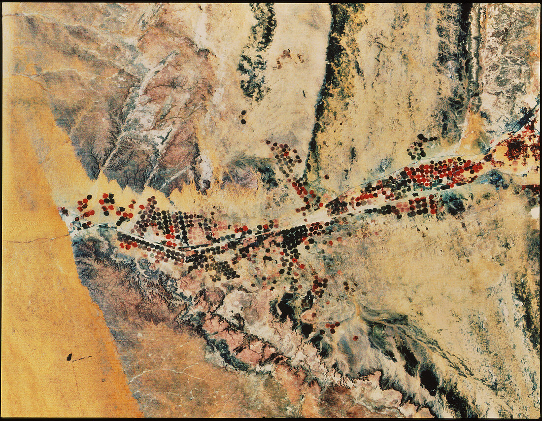
| False-colour Landsat satellite image of circular,pivotally-irrigated wheat fields east of Riyadh,Saudi Arabia. Young growing corn appears in red,with older,more mature crops appearing almost black. Water is tapped from deep fossil reserves (underground wells) and fed through large rotating booms to water crops that would otherwise die in this barren region. In an effort to approach self-sufficiency in food production the Saudi's instigated an expansion program of irrigated agriculture in the early 1980's. They used this method (called center-pivot) primarily but also introduced some canal irrigation | |
| Lizenzart: | Lizenzpflichtig |
| Credit: | Science Photo Library / US Geological Survey |
| Bildgröße: | 4289 px × 3331 px |
| Modell-Rechte: | nicht erforderlich |
| Eigentums-Rechte: | nicht erforderlich |
| Restrictions: | - |
Preise für dieses Bild ab 15 €
Universitäten & Organisationen
(Informationsmaterial Digital, Informationsmaterial Print, Lehrmaterial Digital etc.)
ab 15 €
Redaktionell
(Bücher, Bücher: Sach- und Fachliteratur, Digitale Medien (redaktionell) etc.)
ab 30 €
Werbung
(Anzeigen, Aussenwerbung, Digitale Medien, Fernsehwerbung, Karten, Werbemittel, Zeitschriften etc.)
ab 55 €
Handelsprodukte
(bedruckte Textilie, Kalender, Postkarte, Grußkarte, Verpackung etc.)
ab 75 €
Pauschalpreise
Rechtepakete für die unbeschränkte Bildnutzung in Print oder Online
ab 495 €